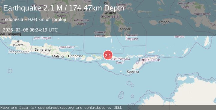
Earthquake Flores Region, Indonesia
Sun, 08 Feb 2026 00:24:19 GMT
Time1 hour ago
Location
-8.1863, 120.0071
Depth
174.5 KM
Event Summary
A 2.1 magnitude earthquake struck on Flores Region, Indonesia, at Sun, 08 Feb 2026 00:24:19 GMT. Depth: 174.472794km. Reviewed by BMKG seismologists, this minor quake occurred at a magnitude type of M.
Magnitude
2.1
M
Source
BMKG
Intensity
-
Agency Reports
1 Sources| Source | Magnitude | Depth | Time |
|---|---|---|---|
| BMKGPrimary | 2.1 | 174 km | 1 hour ago |
Earthquake Details
AutomaticEvent IDbmg2026crlx
Tsunami PotentialNo
Magnitude TypeM
Nearest Places
- Pulau Sababi19.5 km
- Selat Gili Bodo21.3 km
- Saka Sari21.7 km
- Manage21.8 km
- Tanjung Pontianak21.9 km
Comments
Join the discussion about this event.
Latest Earthquakes
1.8Mag
24 km NW of Parkfield, CA
Time7 minutes ago
Depth5.26 km
SourceUSGS (Automatic)
1.1Mag
9 km N of Redwood Valley, CA
Time11 minutes ago
Depth7.67 km
SourceUSGS (Automatic)
1.1Mag
12 km WSW of Stanton, Texas
Time17 minutes ago
Depth4.41 km
SourceUSGS (Automatic)
1.9Mag
48 km SSE of Nelchina, Alaska
Time17 minutes ago
Depth22.00 km
SourceUSGS (Automatic)
3.3Mag
VIRGIN ISLANDS REGION
Time18 minutes ago
Depth35.00 km
SourceNEIC (Automatic)
Nearby Earthquakes
2.8Mag
Flores Region, Indonesia
Time2 weeks ago
Depth174.48 km
SourceBMKG (Automatic)
2.5Mag
Flores Region, Indonesia
Time5 days ago
Depth170.05 km
SourceBMKG (Automatic)
2.7Mag
Flores Region, Indonesia
Time1 day ago
Depth169.17 km
SourceBMKG (Automatic)
2.4Mag
Flores Region, Indonesia
Time1 week ago
Depth175.29 km
SourceBMKG (Automatic)
2.5Mag
Flores Region, Indonesia
Time1 week ago
Depth158.76 km
SourceBMKG (Automatic)