Earthquake Bali Sea
Sun, 08 Feb 2026 04:49:46 GMT
Time1 hour ago
Location
-7.8896, 114.4793
Depth
23.1 KM
Event Summary
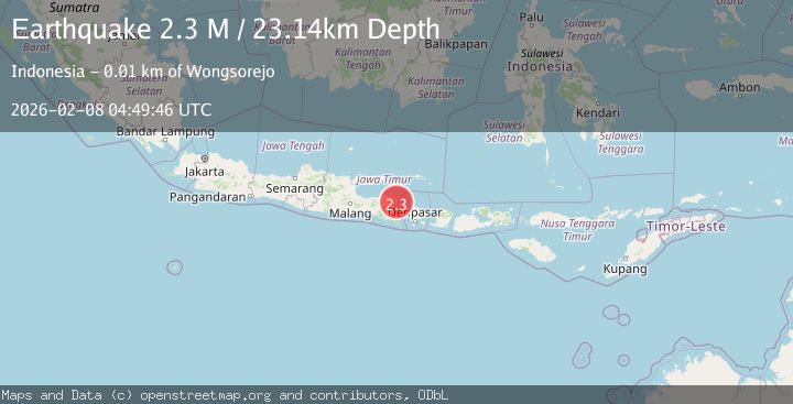
A 2.3 magnitude earthquake struck on Bali Sea, at Sun, 08 Feb 2026 04:49:46 GMT. Depth: 23.140749km. Reviewed by BMKG seismologists, this minor quake occurred at a magnitude type of M.
Magnitude
2.3
M
Source
BMKG
Intensity
-
Agency Reports
1 Sources| Source | Magnitude | Depth | Time |
|---|---|---|---|
| BMKGPrimary | 2.3 | 23 km | 1 hour ago |
Earthquake Details
AutomaticEvent IDbmg2026crur
Tsunami PotentialNo
Magnitude TypeM
Nearest Places
- Tanjung Candibang1.7 km
- Takat Datuk3.1 km
- Teluk Popongan3.8 km
- Bukit Melas4.0 km
- Curah Uling4.0 km
Comments
Join the discussion about this event.
Latest Earthquakes
2.9Mag
Southern Sumatra, Indonesia
Time8 minutes ago
Depth10.00 km
SourceBMKG (Automatic)
2.3Mag
79 km W of Akhiok, Alaska
Time12 minutes ago
Depth32.60 km
SourceUSGS (Automatic)
3.6Mag
MINDANAO, PHILIPPINES
Time18 minutes ago
Depth2.00 km
SourcePIVS (Automatic)
3.0Mag
TARAPACA, CHILE
Time19 minutes ago
Depth121.30 km
SourceCSN (Automatic)
3.8Mag
Near North Coast of West Papua
Time28 minutes ago
Depth13.28 km
SourceBMKG (Automatic)
Nearby Earthquakes
3.1Mag
Bali Region, Indonesia
Time5 days ago
Depth12.36 km
SourceBMKG (Automatic)
2.5Mag
Bali Region, Indonesia
Time2 weeks ago
Depth105.42 km
SourceBMKG (Automatic)
2.5Mag
Bali Sea
Time2 weeks ago
Depth14.54 km
SourceBMKG (Automatic)
2.2Mag
Bali Region, Indonesia
Time6 days ago
Depth13.17 km
SourceBMKG (Automatic)
2.7Mag
Bali Sea
Time1 week ago
Depth22.23 km
SourceBMKG (Automatic)