Earthquake Northern Sumatra, Indonesia
Sun, 08 Feb 2026 09:53:57 GMT
Time1 hour ago
Location
4.1635, 97.4164
Depth
1.0 KM
Event Summary
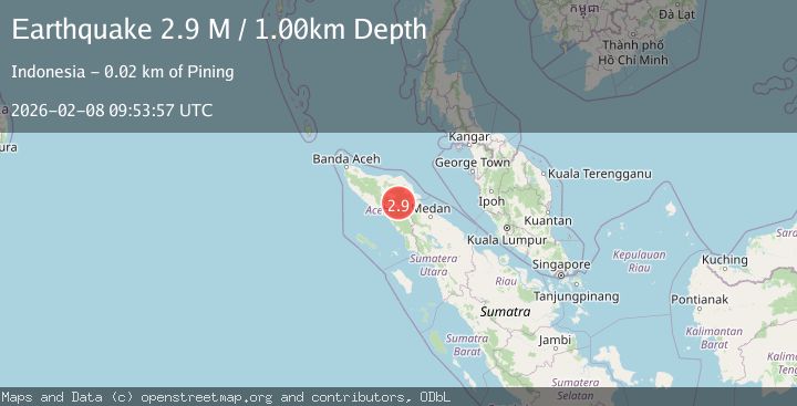
A 2.9 magnitude earthquake struck on Northern Sumatra, Indonesia, at Sun, 08 Feb 2026 09:53:57 GMT. Depth: 1km. Reviewed by BMKG seismologists, this minor quake occurred at a magnitude type of M.
Magnitude
2.9
M
Source
BMKG
Intensity
-
Agency Reports
1 Sources| Source | Magnitude | Depth | Time |
|---|---|---|---|
| BMKGPrimary | 2.9 | 1 km | 1 hour ago |
Earthquake Details
AutomaticEvent IDbmg2026cses
Tsunami PotentialNo
Magnitude TypeM
Nearest Places
- Burni Siluman1.3 km
- Burni Pepelar1.5 km
- Burni Apitan3.0 km
- Gunung Lojang3.1 km
- Van Daalen Mountains3.7 km
Comments
Join the discussion about this event.
Latest Earthquakes
1.1Mag
22 km E of Julian, CA
Time10 minutes ago
Depth14.39 km
SourceUSGS (Automatic)
2.0Mag
STRAIT OF GIBRALTAR
Time19 minutes ago
Depth0.00 km
SourceIGN (Automatic)
2.4Mag
Minahassa Peninsula, Sulawesi
Time27 minutes ago
Depth130.30 km
SourceBMKG (Automatic)
3.5Mag
SALTA, ARGENTINA
Time31 minutes ago
Depth146.00 km
SourceNSNA (Automatic)
3.0Mag
Northern Molucca Sea
Time31 minutes ago
Depth28.83 km
SourceBMKG (Automatic)
Nearby Earthquakes
2.9Mag
Northern Sumatra, Indonesia
Time2 days ago
Depth3.00 km
SourceBMKG (Automatic)
2.1Mag
Northern Sumatra, Indonesia
Time6 days ago
Depth2.00 km
SourceBMKG (Automatic)
2.7Mag
Northern Sumatra, Indonesia
Time1 week ago
Depth0.60 km
SourceBMKG (Automatic)
2.2Mag
Northern Sumatra, Indonesia
Time4 days ago
Depth5.00 km
SourceBMKG (Automatic)
2.2Mag
Northern Sumatra, Indonesia
Time2 weeks ago
Depth2.00 km
SourceBMKG (Automatic)