Earthquake Northern Sumatra, Indonesia
Fri, 06 Feb 2026 10:52:54 GMT
Time1 hour ago
Location
4.1483, 97.4203
Depth
3.0 KM
Event Summary
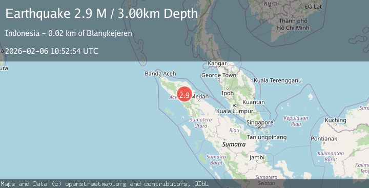
A 2.9 magnitude earthquake struck on Northern Sumatra, Indonesia, at Fri, 06 Feb 2026 10:52:54 GMT. Depth: 3km. Reviewed by BMKG seismologists, this minor quake occurred at a magnitude type of M.
Magnitude
2.9
M
Source
BMKG
Intensity
-
Agency Reports
1 Sources| Source | Magnitude | Depth | Time |
|---|---|---|---|
| BMKGPrimary | 2.9 | 3 km | 1 hour ago |
Earthquake Details
AutomaticEvent IDbmg2026copq
Tsunami PotentialNo
Magnitude TypeM
Nearest Places
- Burni Siluman0.5 km
- Burni Apitan1.7 km
- Burni Pepelar2.4 km
- Gunung Lojang4.3 km
- Gunung Aber4.4 km
Comments
Join the discussion about this event.
Latest Earthquakes
1.7Mag
68 km ESE of Cantwell, Alaska
Time8 minutes ago
Depth8.20 km
SourceUSGS (Automatic)
2.1Mag
West Papua Region, Indonesia
Time8 minutes ago
Depth6.00 km
SourceBMKG (Automatic)
2.1Mag
Northern Sumatra, Indonesia
Time8 minutes ago
Depth0.57 km
SourceBMKG (Automatic)
2.5Mag
FRANCE
Time14 minutes ago
Depth5.00 km
SourceReNaSS (Automatic)
3.8Mag
Near North Coast of West Papua
Time17 minutes ago
Depth11.63 km
SourceBMKG (Automatic)
Nearby Earthquakes
2.2Mag
Northern Sumatra, Indonesia
Time1 week ago
Depth2.00 km
SourceBMKG (Automatic)
3.4Mag
Northern Sumatra, Indonesia
Time6 days ago
Depth3.00 km
SourceBMKG (Automatic)
2.1Mag
Northern Sumatra, Indonesia
Time4 days ago
Depth2.00 km
SourceBMKG (Automatic)
2.3Mag
Northern Sumatra, Indonesia
Time4 days ago
Depth1.11 km
SourceBMKG (Automatic)
2.2Mag
Northern Sumatra, Indonesia
Time2 days ago
Depth5.00 km
SourceBMKG (Automatic)