Earthquake Northern Sumatra, Indonesia
Sun, 08 Feb 2026 13:25:19 GMT
Time1 hour ago
Location
0.1395, 99.9973
Depth
10.0 KM
Event Summary
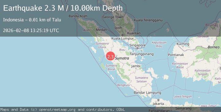
A 2.3 magnitude earthquake struck on Northern Sumatra, Indonesia, at Sun, 08 Feb 2026 13:25:19 GMT. Depth: 10km. Reviewed by BMKG seismologists, this minor quake occurred at a magnitude type of M.
Magnitude
2.3
M
Source
BMKG
Intensity
-
Agency Reports
1 Sources| Source | Magnitude | Depth | Time |
|---|---|---|---|
| BMKGPrimary | 2.3 | 10 km | 1 hour ago |
Earthquake Details
AutomaticEvent IDbmg2026cslr
Tsunami PotentialNo
Magnitude TypeM
Nearest Places
- Simpang1.4 km
- Timboabu2.5 km
- Mudiksimpang3.5 km
- Rantaupauh4.7 km
- Karambil5.4 km
Comments
Join the discussion about this event.
Latest Earthquakes
1.1Mag
13 km SSW of Borrego Springs, CA
Time5 minutes ago
Depth8.80 km
SourceUSGS (Automatic)
4.1Mag
COOK STRAIT, NEW ZEALAND
Time10 minutes ago
Depth51.60 km
SourceGNS (Automatic)
3.0Mag
Minahassa Peninsula, Sulawesi
Time13 minutes ago
Depth142.13 km
SourceBMKG (Automatic)
2.8Mag
SOUTHERN TEXAS
Time15 minutes ago
Depth7.00 km
SourceTX (Automatic)
3.1Mag
ANTOFAGASTA, CHILE
Time17 minutes ago
Depth7.50 km
SourceCSN (Automatic)
Nearby Earthquakes
2.4Mag
Northern Sumatra, Indonesia
Time4 days ago
Depth9.60 km
SourceBMKG (Automatic)
2.5Mag
NORTHERN SUMATRA, INDONESIA
Time2 weeks ago
Depth8.00 km
SourceBMKG (Automatic)
2.3Mag
Northern Sumatra, Indonesia
Time3 days ago
Depth4.90 km
SourceBMKG (Automatic)
2.7Mag
Northern Sumatra, Indonesia
Time1 week ago
Depth14.71 km
SourceBMKG (Automatic)
2.1Mag
Southern Sumatra, Indonesia
Time1 week ago
Depth17.85 km
SourceBMKG (Automatic)