Earthquake Bali Sea
Mon, 09 Feb 2026 14:32:11 GMT
Time3 hours ago
Location
-7.9909, 117.7522
Depth
7.7 KM
Event Summary
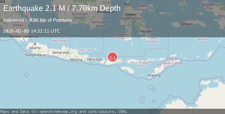
A 2.1 magnitude earthquake struck on Bali Sea, at Mon, 09 Feb 2026 14:32:11 GMT. Depth: 7.700003km. Reviewed by BMKG seismologists, this minor quake occurred at a magnitude type of M.
Magnitude
2.1
M
Source
BMKG
Intensity
-
Agency Reports
1 Sources| Source | Magnitude | Depth | Time |
|---|---|---|---|
| BMKGPrimary | 2.1 | 8 km | 3 hours ago |
Earthquake Details
AutomaticEvent IDbmg2026cujk
Tsunami PotentialNo
Magnitude TypeM
Nearest Places
- Satonda Peak12.5 km
- Pulau Satonda13.1 km
- Ndano Satonda13.4 km
- Sori Jati16.1 km
- Teluk Nanganae16.6 km
Comments
Join the discussion about this event.
Latest Earthquakes
0.7Mag
7 km NW of The Geysers, CA
Time3 hours ago
Depth2.79 km
SourceUSGS (Automatic)
0.8Mag
103 km N of Karluk, Alaska
Time3 hours ago
Depth5.00 km
SourceUSGS (Automatic)
1.6Mag
STRAIT OF GIBRALTAR
Time3 hours ago
Depth0.00 km
SourceIGN (Automatic)
2.6Mag
Java, Indonesia
Time3 hours ago
Depth5.00 km
SourceBMKG (Automatic)
1.4Mag
NORTHERN ITALY
Time3 hours ago
Depth1.80 km
SourceETHZ (Automatic)
Nearby Earthquakes
2.5Mag
Bali Sea
Time1 week ago
Depth15.24 km
SourceBMKG (Automatic)
2.1Mag
Sumbawa Region, Indonesia
Time1 week ago
Depth13.99 km
SourceBMKG (Automatic)
2.1Mag
Bali Sea
Time1 week ago
Depth10.00 km
SourceBMKG (Automatic)
2.3Mag
Bali Sea
Time1 week ago
Depth13.31 km
SourceBMKG (Automatic)
2.1Mag
Sumbawa Region, Indonesia
Time6 days ago
Depth10.00 km
SourceBMKG (Automatic)