Earthquake Banda Sea
Mon, 09 Feb 2026 22:02:04 GMT
Time2 hours ago
Location
-7.4376, 128.4188
Depth
191.3 KM
Event Summary
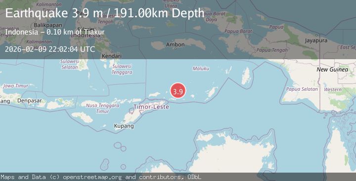
A 3.9 magnitude earthquake struck on Banda Sea, at Mon, 09 Feb 2026 22:02:04 GMT. Depth: 191.33519km. Reviewed by BMKG seismologists, this minor quake occurred at a magnitude type of M.
Magnitude
3.9
M
Source
BMKG
Intensity
-
Agency Reports
1 Sources| Source | Magnitude | Depth | Time |
|---|---|---|---|
| BMKGPrimary | 3.9 | 191 km | 2 hours ago |
Earthquake Details
AutomaticEvent IDbmg2026cuyg
Tsunami PotentialNo
Magnitude TypeM
Nearest Places
- Pulau Terbang Selatan17.2 km
- Pulau Terbang Utara22.2 km
- Pulau Musleur24.3 km
- Tanjung Paran34.6 km
- Tanjung Tutitlakani35.1 km
Comments
Join the discussion about this event.
Latest Earthquakes
1.1Mag
5 km NNW of Rancho Cucamonga, CA
Time2 hours ago
Depth12.52 km
SourceUSGS (Automatic)
1.9Mag
4 km SW of Tahoe Vista, CA
Time2 hours ago
Depth3.91 km
SourceUSGS (Automatic)
1.6Mag
13 km W of Point Possession, Alaska
Time2 hours ago
Depth7.70 km
SourceUSGS (Automatic)
1.5Mag
28 km ENE of Chase, Alaska
Time2 hours ago
Depth5.00 km
SourceUSGS (Automatic)
2.2Mag
95 km NW of Yakutat, Alaska
Time2 hours ago
Depth16.90 km
SourceUSGS (Automatic)
Nearby Earthquakes
3.8Mag
Banda Sea
Time2 weeks ago
Depth199.25 km
SourceBMKG (Automatic)
3.6Mag
KEPULAUAN BARAT DAYA, INDONESIA
Time1 week ago
Depth172.00 km
SourceBMKG (Automatic)
4.6Mag
Banda Sea
Time4 days ago
Depth195.76 km
SourceBMKG (Automatic)
3.8Mag
KEPULAUAN BARAT DAYA, INDONESIA
Time1 week ago
Depth110.00 km
SourceBMKG (Automatic)
5.0Mag
Banda Sea
Time1 week ago
Depth160.88 km
SourceBMKG (Automatic)