Earthquake Sumbawa Region, Indonesia
Tue, 10 Feb 2026 02:28:22 GMT
Time7 hours ago
Location
-9.3177, 117.1440
Depth
38.2 KM
Event Summary
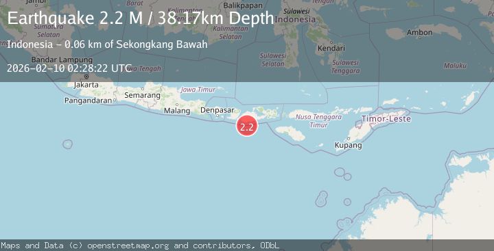
A 2.2 magnitude earthquake struck on Sumbawa Region, Indonesia, at Tue, 10 Feb 2026 02:28:22 GMT. Depth: 38.174522km. Reviewed by BMKG seismologists, this minor quake occurred at a magnitude type of M.
Magnitude
2.2
M
Source
BMKG
Intensity
-
Agency Reports
1 Sources| Source | Magnitude | Depth | Time |
|---|---|---|---|
| BMKGPrimary | 2.2 | 38 km | 7 hours ago |
Earthquake Details
ManualEvent IDbmg2026cvha
Tsunami PotentialNo
Magnitude TypeM
Nearest Places
- Tanjung Talonan25.4 km
- Tanjung Sarang Ode25.8 km
- Tanu Tanjunglilin25.8 km
- Tanjung Batubongkang26.1 km
- Boa Momil27.3 km
Comments
Join the discussion about this event.
Latest Earthquakes
2.8Mag
WESTERN TURKEY
Time6 hours ago
Depth11.30 km
SourceKOERI (Automatic)
2.7Mag
WESTERN TURKEY
Time6 hours ago
Depth9.40 km
SourceEMSC (Automatic)
2.7Mag
WESTERN TURKEY
Time6 hours ago
Depth9.40 km
SourceAFAD (Automatic)
2.8Mag
13 km SW of Pedro Bay, Alaska
Time7 hours ago
Depth175.60 km
SourceUSGS (Automatic)
2.1Mag
NORTHERN CALIFORNIA
Time7 hours ago
Depth1.70 km
SourceNC (Automatic)
Nearby Earthquakes
2.7Mag
Sumbawa Region, Indonesia
Time3 days ago
Depth10.00 km
SourceBMKG (Automatic)
2.3Mag
Sumbawa Region, Indonesia
Time1 week ago
Depth24.84 km
SourceBMKG (Automatic)
2.3Mag
Sumbawa Region, Indonesia
Time6 days ago
Depth32.94 km
SourceBMKG (Automatic)
2.3Mag
Sumbawa Region, Indonesia
Time1 week ago
Depth40.80 km
SourceBMKG (Automatic)
2.7Mag
Sumbawa Region, Indonesia
Time6 days ago
Depth31.43 km
SourceBMKG (Automatic)