Earthquake South of Sumbawa, Indonesia
Tue, 10 Feb 2026 07:44:43 GMT
Time2 hours ago
Location
-11.0021, 118.4334
Depth
10.0 KM
Event Summary
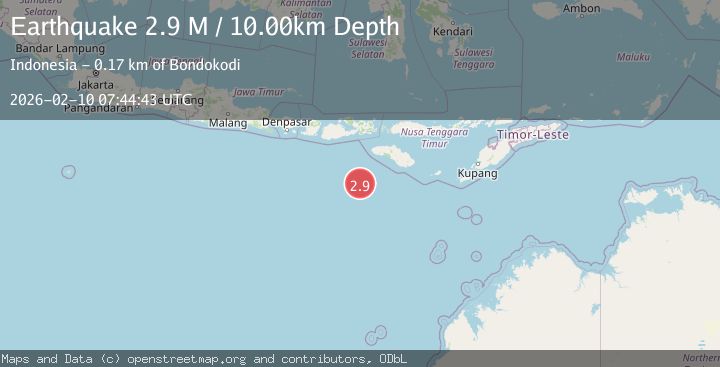
A 2.9 magnitude earthquake struck on South of Sumbawa, Indonesia, at Tue, 10 Feb 2026 07:44:43 GMT. Depth: 10km. Reviewed by BMKG seismologists, this minor quake occurred at a magnitude type of M.
Magnitude
2.9
M
Source
BMKG
Intensity
-
Agency Reports
1 Sources| Source | Magnitude | Depth | Time |
|---|---|---|---|
| BMKGPrimary | 2.9 | 10 km | 2 hours ago |
Earthquake Details
ManualEvent IDbmg2026cvrl
Tsunami PotentialNo
Magnitude TypeM
Nearest Places
- Corona Bank155.4 km
- Tanjung Mareha160.1 km
- Tanjung Waikataku160.2 km
- Pulau Malondobara160.5 km
- Tanjung Rica160.5 km
Comments
Join the discussion about this event.
Latest Earthquakes
2.5Mag
Southern Sumatra, Indonesia
Time2 hours ago
Depth8.27 km
SourceBMKG
2.1Mag
Northern Territory, Australia
Time2 hours ago
Depth18.80 km
SourceVYT (Automatic)
1.3Mag
10 km NE of Coahoma, Texas
Time2 hours ago
Depth2.85 km
SourceUSGS (Automatic)
1.3Mag
Southern Alaska
Time2 hours ago
Depth74.46 km
SourceVYT (Automatic)
2.9Mag
OFFSHORE NORTHERN CALIFORNIA
Time2 hours ago
Depth16.70 km
SourceNC (Automatic)
Nearby Earthquakes
3.1Mag
South of Sumbawa, Indonesia
Time5 days ago
Depth37.44 km
SourceBMKG (Automatic)
3.3Mag
South of Sumbawa, Indonesia
Time2 weeks ago
Depth10.00 km
SourceBMKG (Automatic)
3.1Mag
South of Sumbawa, Indonesia
Time1 week ago
Depth10.00 km
SourceBMKG (Automatic)
3.0Mag
South of Sumbawa, Indonesia
Time1 week ago
Depth0.00 km
SourceBMKG (Automatic)
3.2Mag
South of Sumbawa, Indonesia
Time1 week ago
Depth10.00 km
SourceBMKG (Automatic)