Earthquake 10 km NE of Coahoma, Texas
Tue, 10 Feb 2026 07:23:17 GMT
Time1 hour ago
Location
32.3570, -101.2150
Depth
2.9 KM
Event Summary
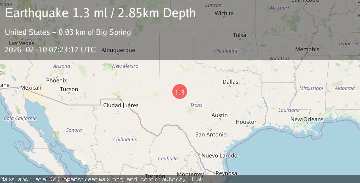
A 1.3 magnitude earthquake struck on 10 km NE of Coahoma, Texas, at Tue, 10 Feb 2026 07:23:17 GMT. Depth: 2.8518km. Reviewed by USGS seismologists, this minor quake occurred at a magnitude type of ml.
Magnitude
1.3
ml
Source
USGS
Intensity
-
Agency Reports
1 Sources| Source | Magnitude | Depth | Time |
|---|---|---|---|
| USGSPrimary | 1.3 | 3 km | 1 hour ago |
Earthquake Details
AutomaticEvent IDusgs_tx2026cvztfj
Tsunami PotentialNo
Magnitude Typeml
Nearest Places
- Iatan Flats3.6 km
- Wildhorse Mountain3.9 km
- Rattlesnake Gap4.3 km
- Hansford County Library4.7 km
- Wildhorse Creek5.5 km
Comments
Join the discussion about this event.
Latest Earthquakes
1.0Mag
9 km ESE of Ocotillo Wells, CA
Time46 minutes ago
Depth8.78 km
SourceUSGS (Automatic)
1.5Mag
Southern Alaska
Time46 minutes ago
Depth0.00 km
SourceVYT (Automatic)
1.2Mag
SLOVENIA
Time58 minutes ago
Depth5.70 km
SourceARSO (Automatic)
2.6Mag
Region Metropolitana, Chile
Time59 minutes ago
Depth107.18 km
SourceVYT (Automatic)
2.9Mag
South of Sumbawa, Indonesia
Time1 hour ago
Depth10.00 km
SourceBMKG
Nearby Earthquakes
2.6Mag
WESTERN TEXAS
Time5 days ago
Depth1.60 km
SourceTX (Automatic)
1.7Mag
3 km NNW of Westbrook, Texas
Time4 days ago
Depth0.09 km
SourceUSGS (Automatic)
2.1Mag
WESTERN TEXAS
Time2 days ago
Depth2.80 km
SourceTX (Automatic)
1.2Mag
24 km NNW of Westbrook, Texas
Time3 days ago
Depth4.04 km
SourceUSGS (Automatic)
1.3Mag
24 km NNW of Westbrook, Texas
Time2 weeks ago
Depth3.71 km
SourceUSGS (Automatic)