Earthquake OFFSHORE NORTHERN CALIFORNIA
Tue, 10 Feb 2026 07:22:07 GMT
Time1 hour ago
Location
40.3510, -124.7198
Depth
16.7 KM
Event Summary
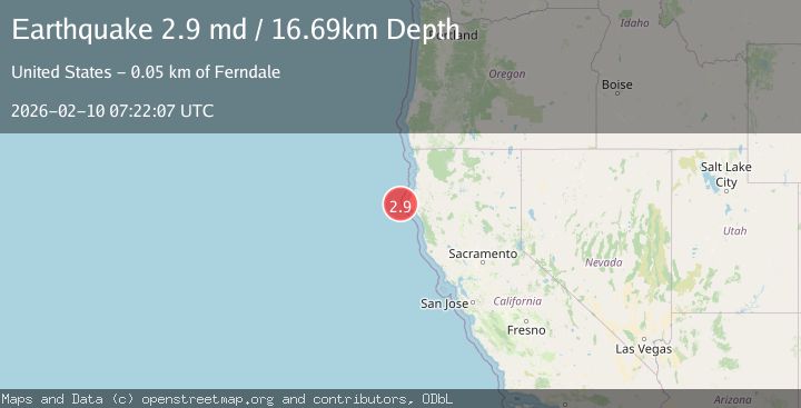
A 2.9 magnitude earthquake struck on OFFSHORE NORTHERN CALIFORNIA, at Tue, 10 Feb 2026 07:22:07 GMT. Depth: 16.7km. Reviewed by NC seismologists, this minor quake occurred at a magnitude type of md.
Magnitude
2.9
md
Source
NC
Intensity
-
Agency Reports
1 Sources| Source | Magnitude | Depth | Time |
|---|---|---|---|
| NCPrimary | 2.9 | 17 km | 1 hour ago |
Earthquake Details
AutomaticEvent IDemsc_NC_20260210_0000097
Tsunami PotentialNo
Magnitude Typemd
Nearest Places
- Mendocino Canyon9.6 km
- Bear Valley14.9 km
- Blunts Reef Coast Guard Station20.7 km
- Blunts Reef Lightship (historical)21.5 km
- Mendocino Canyon22.9 km
Comments
Join the discussion about this event.
Latest Earthquakes
1.3Mag
Southern Alaska
Time1 hour ago
Depth74.46 km
SourceVYT (Automatic)
2.4Mag
southern Sumatra, Indonesia
Time1 hour ago
Depth0.00 km
SourceVYT (Automatic)
2.4Mag
Java, Indonesia
Time1 hour ago
Depth53.60 km
SourceBMKG
2.2Mag
Alaska Peninsula
Time1 hour ago
Depth27.95 km
SourceVYT (Automatic)
1.0Mag
Pyrenees
Time1 hour ago
Depth0.00 km
SourceVYT (Automatic)
Nearby Earthquakes
3.4Mag
OFFSHORE NORTHERN CALIFORNIA
Time1 week ago
Depth16.60 km
SourceNC (Automatic)
2.4Mag
38 km W of Petrolia, CA
Time1 week ago
Depth12.06 km
SourceUSGS (Automatic)
2.2Mag
OFFSHORE NORTHERN CALIFORNIA
Time4 days ago
Depth7.30 km
SourceNC (Automatic)
2.3Mag
22 km W of Petrolia, CA
Time2 weeks ago
Depth11.53 km
SourceUSGS (Automatic)
1.9Mag
18 km W of Petrolia, CA
Time2 weeks ago
Depth18.85 km
SourceUSGS (Automatic)