Earthquake Southwest of Sumatra, Indonesia
Wed, 11 Feb 2026 01:46:04 GMT
Time1 week ago
Location
-6.1736, 103.6589
Depth
10.0 KM
Event Summary
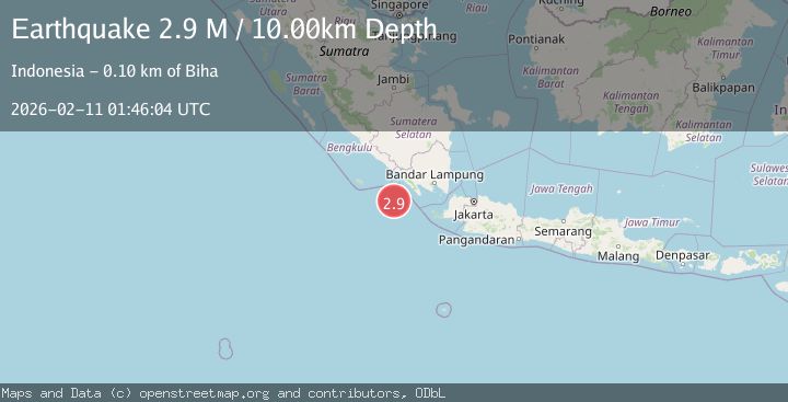
A 2.9 magnitude earthquake struck on Southwest of Sumatra, Indonesia, at Wed, 11 Feb 2026 01:46:04 GMT. Depth: 10km. Reviewed by BMKG seismologists, this minor quake occurred at a magnitude type of M.
Magnitude
2.9
M
Source
BMKG
Intensity
-
Agency Reports
1 Sources| Source | Magnitude | Depth | Time |
|---|---|---|---|
| BMKGPrimary | 2.9 | 10 km | 1 week ago |
Earthquake Details
ManualEvent IDbmg2026cxbd
Tsunami PotentialNo
Magnitude TypeM
Nearest Places
- Enggano Basin21.8 km
- Pulau Betuah92.2 km
- Cukuh Batuberagam93.4 km
- Ujung Siging94.2 km
- Teluk Bengkunat94.2 km
Comments
Join the discussion about this event.
Latest Earthquakes
1.3Mag
Southeastern Alaska
Time7 minutes ago
Depth1.71 km
SourceVYT (Automatic)
1.3Mag
WESTERN TURKEY
Time11 minutes ago
Depth7.00 km
SourceAFAD (Automatic)
2.9Mag
Central Alaska
Time12 minutes ago
Depth0.00 km
SourceVYT (Automatic)
1.9Mag
Kenai Peninsula, Alaska
Time14 minutes ago
Depth67.87 km
SourceVYT (Automatic)
1.2Mag
Southeastern Alaska
Time18 minutes ago
Depth35.28 km
SourceVYT (Automatic)
Nearby Earthquakes
4.0Mag
SOUTHWEST OF SUMATRA, INDONESIA
Time3 years ago
Depth10.00 km
SourceDJA (Automatic)
5.2Mag
SOUTHWEST OF SUMATRA, INDONESIA
Time1 year ago
Depth10.00 km
SourceEMSC (Automatic)
5.0Mag
SOUTHWEST OF SUMATRA, INDONESIA
Time18 years ago
Depth35.00 km
SourceNEIC (Automatic)
5.2Mag
SOUTHWEST OF SUMATRA, INDONESIA
Time7 years ago
Depth60.00 km
SourceEMSC (Automatic)
3.3Mag
Southwest of Sumatra, Indonesia
Time3 weeks ago
Depth25.24 km
SourceBMKG (Automatic)