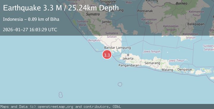
Earthquake Southwest of Sumatra, Indonesia
Tue, 27 Jan 2026 16:03:29 GMT
Time4 hours ago
Location
-6.1236, 103.7383
Depth
26.9 KM
Event Summary
A 3.2 magnitude earthquake struck on Southwest of Sumatra, Indonesia, at Tue, 27 Jan 2026 16:03:29 GMT. Depth: 26.884411km. Reviewed by BMKG seismologists, this minor quake occurred at a magnitude type of M.
Magnitude
3.2
M
Source
BMKG
Intensity
-
Agency Reports
1 Sources| Source | Magnitude | Depth | Time |
|---|---|---|---|
| BMKGPrimary | 3.2 | 27 km | 4 hours ago |
Earthquake Details
AutomaticEvent IDbmg2026bwsw
Tsunami PotentialNo
Magnitude TypeM
Nearest Places
- Enggano Basin13.8 km
- Pulau Betuah82.0 km
- Cukuh Batuberagam83.1 km
- Teluk Bengkunat84.0 km
- Wai Heni84.3 km
Comments
Join the discussion about this event.
Latest Earthquakes
0.7Mag
10 km NNW of Anza, CA
Time4 hours ago
Depth15.79 km
SourceUSGS (Automatic)
2.5Mag
Minahassa Peninsula, Sulawesi
Time4 hours ago
Depth26.01 km
SourceBMKG (Automatic)
2.2Mag
67 km WSW of Coronado, CA
Time5 hours ago
Depth9.71 km
SourceUSGS (Automatic)
5.0Mag
Mindanao, Philippines
Time5 hours ago
Depth10.00 km
SourceBMKG (Automatic)
1.4Mag
37 km NW of Stanton, Texas
Time5 hours ago
Depth4.38 km
SourceUSGS (Automatic)
Nearby Earthquakes
3.7Mag
Southwest of Sumatra, Indonesia
Time2 days ago
Depth3.70 km
SourceBMKG (Automatic)
2.9Mag
SOUTHWEST OF SUMATRA, INDONESIA
Time4 days ago
Depth10.00 km
SourceBMKG (Automatic)
2.9Mag
Southern Sumatra, Indonesia
Time1 day ago
Depth22.12 km
SourceBMKG (Automatic)
2.7Mag
Sunda Strait, Indonesia
Time2 days ago
Depth26.51 km
SourceBMKG (Automatic)
2.7Mag
Southern Sumatra, Indonesia
Time3 days ago
Depth27.97 km
SourceBMKG (Automatic)