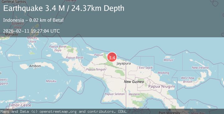
Earthquake Near North Coast of West Papua
Wed, 11 Feb 2026 19:27:04 GMT
Time1 week ago
Location
-2.0972, 139.0794
Depth
24.4 KM
Event Summary
A 3.4 magnitude earthquake struck on Near North Coast of West Papua, at Wed, 11 Feb 2026 19:27:04 GMT. Depth: 24.365576km. Reviewed by BMKG seismologists, this minor quake occurred at a magnitude type of M.
Magnitude
3.4
M
Source
BMKG
Intensity
-
Agency Reports
1 Sources| Source | Magnitude | Depth | Time |
|---|---|---|---|
| BMKGPrimary | 3.4 | 24 km | 1 week ago |
Earthquake Details
ManualEvent IDbmg2026cykd
Tsunami PotentialNo
Magnitude TypeM
Nearest Places
- Sungai Unk3.3 km
- Sungai Sief3.3 km
- Kampung Dabe Dua5.5 km
- Kampung Finyabor Dua7.0 km
- Kampung Tambrawar7.2 km
Comments
Join the discussion about this event.
Latest Earthquakes
1.8Mag
Southern Alaska
Time3 hours ago
Depth10.00 km
SourceVYT (Automatic)
2.0Mag
Southern Alaska
Time3 hours ago
Depth29.91 km
SourceVYT (Automatic)
1.1Mag
2 km NNE of The Geysers, CA
Time3 hours ago
Depth2.51 km
SourceUSGS (Automatic)
2.2Mag
Dead Sea region
Time3 hours ago
Depth1.95 km
SourceVYT (Automatic)
2.3Mag
CENTRAL TURKEY
Time3 hours ago
Depth8.40 km
SourceKOERI (Automatic)
Nearby Earthquakes
5.7Mag
NEAR N COAST OF PAPUA, INDONESIA
Time19 years ago
Depth10.00 km
SourceEMSC (Automatic)
5.0Mag
NEAR N COAST OF PAPUA, INDONESIA
Time14 years ago
Depth40.00 km
SourceEMSC (Automatic)
5.1Mag
NEAR N COAST OF PAPUA, INDONESIA
Time13 years ago
Depth30.00 km
SourceEMSC (Automatic)
5.1Mag
NEAR N COAST OF PAPUA, INDONESIA
Time7 years ago
Depth30.00 km
SourceEMSC (Automatic)
3.0Mag
NEAR N COAST OF PAPUA, INDONESIA
Time2 months ago
Depth23.00 km
SourceBMKG (Automatic)