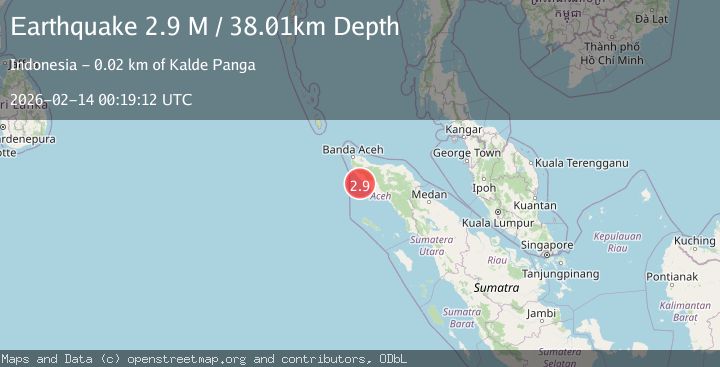
Earthquake Northern Sumatra, Indonesia
Sat, 14 Feb 2026 00:19:12 GMT
Time5 days ago
Location
4.3972, 95.6596
Depth
38.0 KM
Event Summary
A 2.9 magnitude earthquake struck on Northern Sumatra, Indonesia, at Sat, 14 Feb 2026 00:19:12 GMT. Depth: 38.007298km. Reviewed by BMKG seismologists, this minor quake occurred at a magnitude type of M.
Magnitude
2.9
M
Source
BMKG
Intensity
-
Agency Reports
1 Sources| Source | Magnitude | Depth | Time |
|---|---|---|---|
| BMKGPrimary | 2.9 | 38 km | 5 days ago |
Earthquake Details
ManualEvent IDbmg2026dckt
Tsunami PotentialNo
Magnitude TypeM
Nearest Places
- Krueng Seuneubok Padang15.3 km
- Gampong Keude Panga16.2 km
- Krueng Teunom16.3 km
- Lung Lho16.5 km
- Gampong Batee Roo16.6 km
Comments
Join the discussion about this event.
Latest Earthquakes
2.1Mag
Halmahera, Indonesia
Time5 hours ago
Depth4.45 km
SourceBMKG
3.4Mag
Talaud Islands, Indonesia
Time5 hours ago
Depth98.99 km
SourceBMKG
2.1Mag
Flores Region, Indonesia
Time5 hours ago
Depth165.90 km
SourceBMKG
2.4Mag
Sumbawa region, Indonesia
Time5 hours ago
Depth19.65 km
SourceVYT (Automatic)
2.1Mag
Poland
Time5 hours ago
Depth1.95 km
SourceVYT (Automatic)
Nearby Earthquakes
5.1Mag
NORTHERN SUMATRA, INDONESIA
Time3 years ago
Depth80.00 km
SourceEMSC (Automatic)
3.0Mag
NORTHERN SUMATRA, INDONESIA
Time9 months ago
Depth49.00 km
SourceBMKG (Automatic)
2.2Mag
Northern Sumatra, Indonesia
Time1 week ago
Depth5.00 km
SourceBMKG (Automatic)
5.0Mag
northern Sumatra, Indonesia
Time6 days ago
Depth29.91 km
SourceVYT (Automatic)
5.2Mag
NORTHERN SUMATRA, INDONESIA
Time4 years ago
Depth63.00 km
SourceEMSC (Automatic)