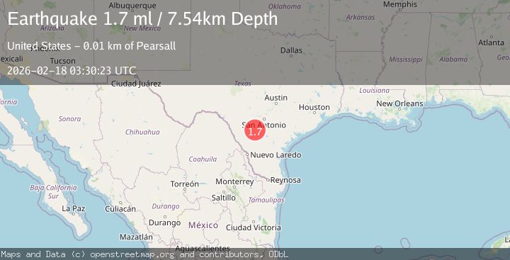
Earthquake 9 km SE of Pearsall, Texas
Wed, 18 Feb 2026 03:30:23 GMT
Time8 hours ago
Location
28.8380, -99.0210
Depth
7.5 KM
Event Summary
A 1.7 magnitude earthquake struck on 9 km SE of Pearsall, Texas, at Wed, 18 Feb 2026 03:30:23 GMT. Depth: 7.5416km. Reviewed by USGS seismologists, this minor quake occurred at a magnitude type of ml.
Magnitude
1.7
ml
Source
USGS
Intensity
-
Agency Reports
1 Sources| Source | Magnitude | Depth | Time |
|---|---|---|---|
| USGSPrimary | 1.7 | 8 km | 8 hours ago |
Earthquake Details
AutomaticEvent IDusgs_tx2026dkjvpt
Tsunami PotentialNo
Magnitude Typeml
Nearest Places
- Buckhorn Cemetery3.3 km
- Jay Kay Ranch Airport4.5 km
- Shipping Trap Windmill5.3 km
- Morrow Lake Number 1 Dam6.0 km
- Morrow Lake Number 16.1 km
Comments
Join the discussion about this event.
Latest Earthquakes
2.0Mag
Seram, Indonesia
Time8 hours ago
Depth68.21 km
SourceBMKG
3.5Mag
near the coast of Antofagasta, Chile
Time8 hours ago
Depth0.00 km
SourceVYT (Automatic)
1.7Mag
Southern California
Time8 hours ago
Depth0.00 km
SourceVYT (Automatic)
3.1Mag
northern Norway
Time8 hours ago
Depth707.40 km
SourceVYT (Automatic)
2.2Mag
DODECANESE IS.-TURKEY BORDER REG
Time8 hours ago
Depth46.60 km
SourceKOERI (Automatic)
Nearby Earthquakes
1.9Mag
9 km SE of Pearsall, Texas
Time1 week ago
Depth8.33 km
SourceUSGS (Automatic)
2.1Mag
SOUTHERN TEXAS
Time3 weeks ago
Depth8.70 km
SourceTX (Automatic)
2.0Mag
SOUTHERN TEXAS
Time3 weeks ago
Depth6.60 km
SourceTX (Automatic)
2.0Mag
SOUTHERN TEXAS
Time2 weeks ago
Depth8.70 km
SourceTX (Automatic)
1.9Mag
8 km ESE of Pearsall, Texas
Time1 week ago
Depth10.61 km
SourceUSGS (Automatic)