Earthquake South of Sumbawa, Indonesia
Tue, 17 Feb 2026 18:26:08 GMT
Time19 hours ago
Location
-11.0066, 118.3795
Depth
10.0 KM
Event Summary
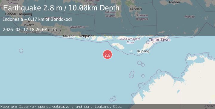
A 2.8 magnitude earthquake struck on South of Sumbawa, Indonesia, at Tue, 17 Feb 2026 18:26:08 GMT. Depth: 10km. Reviewed by BMKG seismologists, this minor quake occurred at a magnitude type of M.
Magnitude
2.8
M
Source
BMKG
Intensity
-
Agency Reports
1 Sources| Source | Magnitude | Depth | Time |
|---|---|---|---|
| BMKGPrimary | 2.8 | 10 km | 19 hours ago |
Earthquake Details
ManualEvent IDbmg2026djhd
Tsunami PotentialNo
Magnitude TypeM
Nearest Places
- Corona Bank155.9 km
- Tanjung Waikataku163.3 km
- Tanjung Mareha163.3 km
- Loko Waikataku163.5 km
- Pulau Malondobara163.7 km
Comments
Join the discussion about this event.
Latest Earthquakes
1.1Mag
6 km WNW of Cobb, CA
Time19 hours ago
Depth1.68 km
SourceUSGS (Automatic)
2.3Mag
Southeastern Alaska
Time19 hours ago
Depth0.00 km
SourceVYT (Automatic)
0.7Mag
Northern Territory, Australia
Time19 hours ago
Depth13.67 km
SourceVYT (Automatic)
2.3Mag
Central Alaska
Time19 hours ago
Depth0.00 km
SourceVYT (Automatic)
3.2Mag
Salta, Argentina
Time19 hours ago
Depth212.89 km
SourceVYT (Automatic)
Nearby Earthquakes
2.9Mag
SOUTH OF SUMBAWA, INDONESIA
Time2 weeks ago
Depth10.00 km
SourceBMKG (Automatic)
2.9Mag
South of Sumbawa, Indonesia
Time1 week ago
Depth10.00 km
SourceBMKG
2.8Mag
SOUTH OF SUMBAWA, INDONESIA
Time1 month ago
Depth10.00 km
SourceBMKG (Automatic)
3.1Mag
South of Sumbawa, Indonesia
Time1 week ago
Depth37.44 km
SourceBMKG (Automatic)
3.0Mag
south of Sumbawa, Indonesia
Time1 day ago
Depth159.91 km
SourceVYT (Automatic)