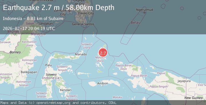
Earthquake Halmahera, Indonesia
Tue, 17 Feb 2026 20:04:19 GMT
Time14 hours ago
Location
1.3741, 128.2702
Depth
58.0 KM
Event Summary
A 2.7 magnitude earthquake struck on Halmahera, Indonesia, at Tue, 17 Feb 2026 20:04:19 GMT. Depth: 58.003693km. Reviewed by BMKG seismologists, this minor quake occurred at a magnitude type of M.
Magnitude
2.7
M
Source
BMKG
Intensity
-
Agency Reports
1 Sources| Source | Magnitude | Depth | Time |
|---|---|---|---|
| BMKGPrimary | 2.7 | 58 km | 14 hours ago |
Earthquake Details
ManualEvent IDbmg2026djkj
Tsunami PotentialNo
Magnitude TypeM
Nearest Places
- Ake Kolocina4.0 km
- Desa Iga4.1 km
- Ake Tutua5.7 km
- Tanjung Tutua5.8 km
- Ake Ifis6.2 km
Comments
Join the discussion about this event.
Latest Earthquakes
2.1Mag
Sumbawa Region, Indonesia
Time14 hours ago
Depth13.19 km
SourceBMKG
1.6Mag
18 km W of Balmorhea, Texas
Time14 hours ago
Depth0.00 km
SourceUSGS (Automatic)
1.6Mag
Southern Alaska
Time14 hours ago
Depth0.85 km
SourceVYT (Automatic)
2.9Mag
Banda Sea
Time14 hours ago
Depth19.17 km
SourceVYT (Automatic)
2.4Mag
WESTERN TURKEY
Time14 hours ago
Depth7.80 km
SourceAFAD (Automatic)
Nearby Earthquakes
2.8Mag
Halmahera, Indonesia
Time3 days ago
Depth0.00 km
SourceVYT (Automatic)
2.5Mag
Halmahera, Indonesia
Time20 hours ago
Depth75.30 km
SourceBMKG
2.8Mag
HALMAHERA, INDONESIA
Time1 month ago
Depth66.00 km
SourceBMKG (Automatic)
5.0Mag
HALMAHERA, INDONESIA
Time12 years ago
Depth109.00 km
SourceEMSC (Automatic)
5.0Mag
HALMAHERA, INDONESIA
Time2 years ago
Depth90.00 km
SourceEMSC (Automatic)