Earthquake Northern Sumatra, Indonesia
Fri, 20 Feb 2026 20:21:11 GMT
Time1 hour ago
Location
4.5743, 96.3239
Depth
2.2 KM
Event Summary
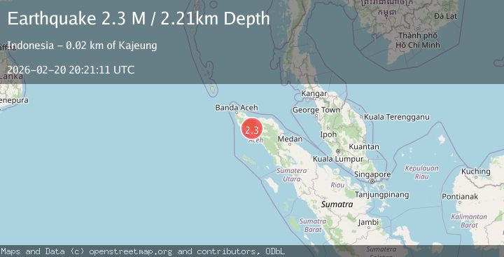
A 2.3 magnitude earthquake struck on Northern Sumatra, Indonesia, at Fri, 20 Feb 2026 20:21:11 GMT. Depth: 2.212021km. Reviewed by BMKG seismologists, this minor quake occurred at a magnitude type of M.
Magnitude
2.3
M
Source
BMKG
Intensity
-
Agency Reports
1 Sources| Source | Magnitude | Depth | Time |
|---|---|---|---|
| BMKGPrimary | 2.3 | 2 km | 1 hour ago |
Earthquake Details
ManualEvent IDbmg2026doxl
Tsunami PotentialNo
Magnitude TypeM
Nearest Places
- 2.2 km
- 2.3 km
- 3.9 km
- 3.9 km
- 3.9 km
Comments
Join the discussion about this event.
Latest Earthquakes
2.9Mag
Unimak Island region, Alaska
Time1 hour ago
Depth22.46 km
SourceVYT (Automatic)
2.8Mag
Potosi, Bolivia
Time1 hour ago
Depth216.67 km
SourceVYT (Automatic)
2.1Mag
Tarapaca, Chile
Time1 hour ago
Depth82.64 km
SourceVYT (Automatic)
2.4Mag
Antofagasta, Chile
Time1 hour ago
Depth172.61 km
SourceVYT (Automatic)
3.0Mag
Central California
Time1 hour ago
Depth17.33 km
SourceVYT (Automatic)
Nearby Earthquakes
3.0Mag
NORTHERN SUMATRA, INDONESIA
Time3 years ago
Depth10.00 km
SourceDJA (Automatic)
5.3Mag
NORTHERN SUMATRA, INDONESIA
Time14 years ago
Depth10.00 km
SourceEMSC (Automatic)
2.5Mag
Northern Sumatra, Indonesia
Time13 hours ago
Depth10.18 km
SourceBMKG
2.4Mag
Northern Sumatra, Indonesia
Time3 days ago
Depth7.72 km
SourceBMKG
2.2Mag
Northern Sumatra, Indonesia
Time1 day ago
Depth8.25 km
SourceBMKG