Earthquake Near North Coast of West Papua
Sun, 22 Feb 2026 21:27:39 GMT
Time1 hour ago
Location
-2.9794, 139.5454
Depth
11.6 KM
Event Summary
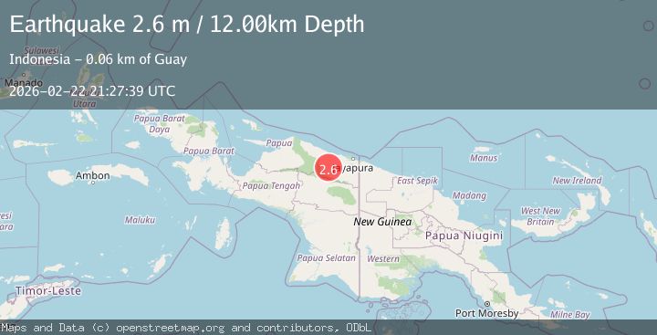
A 2.6 magnitude earthquake struck on Near North Coast of West Papua, at Sun, 22 Feb 2026 21:27:39 GMT. Depth: 11.648235km. Reviewed by BMKG seismologists, this minor quake occurred at a magnitude type of M.
Magnitude
2.6
M
Source
BMKG
Intensity
-
Agency Reports
1 Sources| Source | Magnitude | Depth | Time |
|---|---|---|---|
| BMKGPrimary | 2.6 | 12 km | 1 hour ago |
Earthquake Details
ManualEvent IDbmg2026dsqq
Tsunami PotentialNo
Magnitude TypeM
Nearest Places
- 4.4 km
- 8.4 km
- 16.2 km
- 19.6 km
- 20.4 km
Comments
Join the discussion about this event.
Latest Earthquakes
3.1Mag
Savu Sea
Time1 hour ago
Depth80.32 km
SourceVYT (Automatic)
1.0Mag
25 km ENE of Knik River, Alaska
Time1 hour ago
Depth17.10 km
SourceUSGS (Automatic)
1.0Mag
Southern Alaska
Time1 hour ago
Depth14.40 km
SourceVYT (Automatic)
2.2Mag
Timor region, Indonesia
Time1 hour ago
Depth27.59 km
SourceVYT (Automatic)
3.3Mag
Salta, Argentina
Time1 hour ago
Depth217.29 km
SourceVYT (Automatic)
Nearby Earthquakes
4.5Mag
NEAR N COAST OF PAPUA, INDONESIA
Time1 month ago
Depth50.00 km
SourceEMSC (Automatic)
5.1Mag
NEAR N COAST OF PAPUA, INDONESIA
Time4 years ago
Depth110.00 km
SourceEMSC (Automatic)
2.7Mag
Near North Coast of West Papua
Time1 week ago
Depth10.00 km
SourceBMKG
3.8Mag
Near North Coast of West Papua
Time2 weeks ago
Depth13.28 km
SourceBMKG (Automatic)
3.7Mag
Near North Coast of West Papua
Time1 week ago
Depth8.00 km
SourceBMKG