Earthquake North of Halmahera, Indonesia
Mon, 23 Feb 2026 01:22:33 GMT
Time1 hour ago
Location
3.1850, 128.0557
Depth
37.9 KM
Event Summary
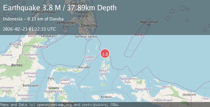
A 3.8 magnitude earthquake struck on North of Halmahera, Indonesia, at Mon, 23 Feb 2026 01:22:33 GMT. Depth: 37.891289km. Reviewed by BMKG seismologists, this minor quake occurred at a magnitude type of M.
Magnitude
3.8
M
Source
BMKG
Intensity
-
Agency Reports
1 Sources| Source | Magnitude | Depth | Time |
|---|---|---|---|
| BMKGPrimary | 3.8 | 38 km | 1 hour ago |
Earthquake Details
ManualEvent IDbmg2026dsyk
Tsunami PotentialNo
Magnitude TypeM
Nearest Places
- 21.5 km
- 63.0 km
- 79.8 km
- 80.0 km
- 81.3 km
Comments
Join the discussion about this event.
Latest Earthquakes
2.3Mag
Tarapaca, Chile
Time1 hour ago
Depth128.05 km
SourceVYT (Automatic)
1.2Mag
Southeastern Alaska
Time1 hour ago
Depth0.00 km
SourceVYT (Automatic)
2.3Mag
134 km E of Chignik, Alaska
Time1 hour ago
Depth53.90 km
SourceUSGS (Automatic)
1.3Mag
Kenai Peninsula, Alaska
Time1 hour ago
Depth31.37 km
SourceVYT (Automatic)
2.1Mag
Tarapaca, Chile
Time1 hour ago
Depth0.00 km
SourceVYT (Automatic)
Nearby Earthquakes
4.0Mag
NORTH OF HALMAHERA, INDONESIA
Time3 years ago
Depth93.00 km
SourceDJA (Automatic)
5.0Mag
NORTH OF HALMAHERA, INDONESIA
Time7 years ago
Depth138.00 km
SourceEMSC (Automatic)
3.4Mag
NORTH OF HALMAHERA, INDONESIA
Time1 month ago
Depth10.00 km
SourceBMKG (Automatic)
2.8Mag
North of Halmahera, Indonesia
Time6 days ago
Depth132.27 km
SourceBMKG
4.0Mag
NORTH OF HALMAHERA, INDONESIA
Time2 years ago
Depth29.00 km
SourceBMKG (Automatic)