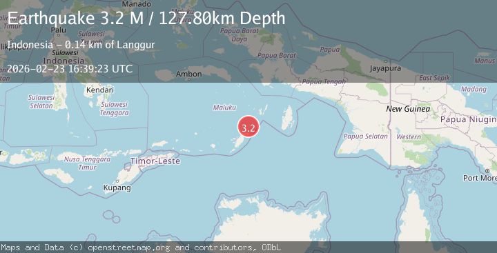
Earthquake Tanimbar Islands Region, Indonesia
Mon, 23 Feb 2026 16:39:25 GMT
Time1 hour ago
Location
-6.7594, 132.2629
Depth
107.7 KM
Event Summary
A 3.2 magnitude earthquake struck on Tanimbar Islands Region, Indonesia, at Mon, 23 Feb 2026 16:39:25 GMT. Depth: 107.650505km. Reviewed by BMKG seismologists, this minor quake occurred at a magnitude type of M.
Magnitude
3.2
M
Source
BMKG
Intensity
-
Agency Reports
1 Sources| Source | Magnitude | Depth | Time |
|---|---|---|---|
| BMKGPrimary | 3.2 | 108 km | 1 hour ago |
Earthquake Details
ManualEvent IDbmg2026ducq
Tsunami PotentialNo
Magnitude TypeM
Nearest Places
- 37.6 km
- 37.9 km
- 40.1 km
- 41.5 km
- 43.5 km
Comments
Join the discussion about this event.
Latest Earthquakes
1.4Mag
Southern Alaska
Time1 hour ago
Depth54.69 km
SourceVYT (Automatic)
2.7Mag
Minahasa, Sulawesi, Indonesia
Time1 hour ago
Depth0.00 km
SourceVYT (Automatic)
3.4Mag
Fox Islands, Aleutian Islands, Alaska
Time1 hour ago
Depth16.24 km
SourceVYT (Automatic)
2.5Mag
Sumba Region, Indonesia
Time1 hour ago
Depth10.00 km
SourceBMKG
1.2Mag
Southeastern Alaska
Time1 hour ago
Depth19.90 km
SourceVYT (Automatic)
Nearby Earthquakes
3.9Mag
Tanimbar Islands Region, Indonesia
Time1 week ago
Depth16.34 km
SourceBMKG
5.2Mag
Tanimbar Islands Region, Indonesia
Time2 weeks ago
Depth101.19 km
SourceBMKG (Automatic)
5.0Mag
KEP. TANIMBAR REGION, INDONESIA
Time6 years ago
Depth10.00 km
SourceEMSC (Automatic)
6.1Mag
KEP. TANIMBAR REGION, INDONESIA
Time3 years ago
Depth10.00 km
SourceEMSC (Automatic)
3.4Mag
KEP. TANIMBAR REGION, INDONESIA
Time1 month ago
Depth104.00 km
SourceBMKG (Automatic)