Earthquake Near North Coast of West Papua
Thu, 26 Feb 2026 11:31:01 GMT
Time1 hour ago
Location
-2.1217, 139.9933
Depth
10.0 KM
Event Summary
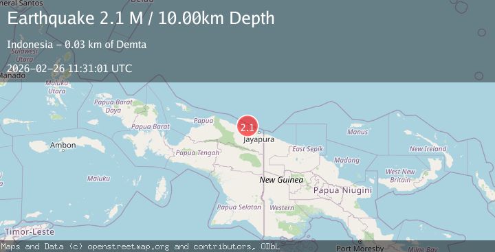
A 2.1 magnitude earthquake struck on Near North Coast of West Papua, at Thu, 26 Feb 2026 11:31:01 GMT. Depth: 10km. Reviewed by BMKG seismologists, this minor quake occurred at a magnitude type of M.
Magnitude
2.1
M
Source
BMKG
Intensity
-
Agency Reports
1 Sources| Source | Magnitude | Depth | Time |
|---|---|---|---|
| BMKGPrimary | 2.1 | 10 km | 1 hour ago |
Earthquake Details
ManualEvent IDbmg2026dzez
Tsunami PotentialNo
Magnitude TypeM
Nearest Places
- 23.1 km
- 25.9 km
- 26.1 km
- 26.7 km
- 26.9 km
Comments
Join the discussion about this event.
Latest Earthquakes
3.1Mag
Sulawesi, Indonesia
Time1 hour ago
Depth0.61 km
SourceVYT (Automatic)
2.4Mag
Flores Sea
Time1 hour ago
Depth119.66 km
SourceBMKG
1.2Mag
61 km NE of Chase, Alaska
Time1 hour ago
Depth62.00 km
SourceUSGS (Automatic)
2.9Mag
Southern Sumatra, Indonesia
Time1 hour ago
Depth24.78 km
SourceBMKG
2.2Mag
Sulawesi, Indonesia
Time1 hour ago
Depth6.56 km
SourceBMKG
Nearby Earthquakes
2.2Mag
Near North Coast of West Papua
Time1 month ago
Depth10.00 km
SourceBMKG (Automatic)
4.0Mag
NEAR N COAST OF PAPUA, INDONESIA
Time6 years ago
Depth10.00 km
SourceDJA (Automatic)
2.5Mag
NEAR N COAST OF PAPUA, INDONESIA
Time1 month ago
Depth10.00 km
SourceBMKG (Automatic)
4.3Mag
near the north coast of Papua, Indonesia
Time2 weeks ago
Depth2.69 km
SourceVYT (Automatic)
2.8Mag
Near North Coast of West Papua
Time1 week ago
Depth18.47 km
SourceBMKG