Earthquake SOUTHERN CALIFORNIA
Sat, 10 Jan 2026 12:48:41 GMT
Time1 day ago
Location
33.7070, -116.8450
Depth
15.2 KM
Event Summary
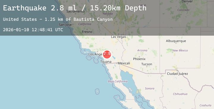
A 2.8 magnitude earthquake struck on SOUTHERN CALIFORNIA, at Sat, 10 Jan 2026 12:48:41 GMT. Depth: 15.2km. Reviewed by SCSN seismologists, this minor quake occurred at a magnitude type of ml.
Magnitude
2.8
ml
Source
SCSN
Intensity
-
Agency Reports
1 Sources| Source | Magnitude | Depth | Time |
|---|---|---|---|
| SCSNPrimary | 2.8 | 15 km | 1 day ago |
Earthquake Details
AutomaticEvent IDemsc_20260110_0000150
Tsunami PotentialNo
Magnitude Typeml
Nearest Places
- Bautista Canyon1.3 km
- Blackburn Canyon1.5 km
- Lake Hemet Main Canal3.5 km
- Cranston Forest Service Station3.5 km
- Willow Brook School3.8 km
Comments
Join the discussion about this event.
Latest Earthquakes
2.2Mag
Minahassa Peninsula, Sulawesi
Time1 day ago
Depth37.20 km
SourceBMKG (Automatic)
2.0Mag
Sumbawa Region, Indonesia
Time1 day ago
Depth10.00 km
SourceBMKG (Automatic)
2.6Mag
Halmahera, Indonesia
Time1 day ago
Depth43.85 km
SourceBMKG (Automatic)
1.8Mag
4 km SSW of Pāhala, Hawaii
Time1 day ago
Depth31.11 km
SourceUSGS (Automatic)
3.0Mag
South of Sumbawa, Indonesia
Time1 day ago
Depth10.00 km
SourceBMKG (Automatic)
Nearby Earthquakes
1.3Mag
17 km ESE of Anza, CA
Time1 day ago
Depth14.15 km
SourceUSGS (Automatic)
1.0Mag
6 km NE of Beaumont, CA
Time1 day ago
Depth17.39 km
SourceUSGS (Automatic)
1.3Mag
10 km SSW of Borrego Springs, CA
Time2 days ago
Depth13.85 km
SourceUSGS (Automatic)
1.3Mag
4 km WNW of Chino, CA
Time2 days ago
Depth0.74 km
SourceUSGS (Automatic)
1.6Mag
10 km E of Yucaipa, CA
Time2 days ago
Depth3.55 km
SourceUSGS (Automatic)