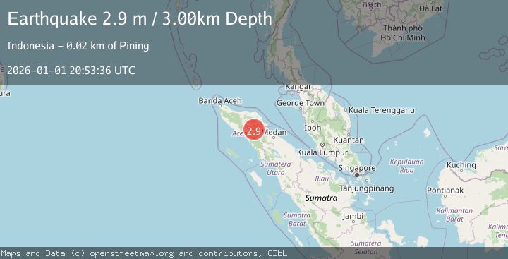
Earthquake NORTHERN SUMATRA, INDONESIA
Thu, 01 Jan 2026 20:53:36 GMT
Time1 month ago
Location
4.1100, 97.4400
Depth
3.0 KM
Event Summary
A 2.9 magnitude earthquake struck on NORTHERN SUMATRA, INDONESIA, at Thu, 01 Jan 2026 20:53:36 GMT. Depth: 3km. Reviewed by BMKG seismologists, this minor quake occurred at a magnitude type of m.
Magnitude
2.9
m
Source
BMKG
Intensity
-
Agency Reports
1 Sources| Source | Magnitude | Depth | Time |
|---|---|---|---|
| BMKGPrimary | 2.9 | 3 km | 1 month ago |
Earthquake Details
AutomaticEvent IDemsc_BMKG_20260101_0000336
Tsunami PotentialNo
Magnitude Typem
Nearest Places
- Gampong Gajah1.3 km
- Waih Gajah3.7 km
- Burni Apitan4.5 km
- Wai Tebing5.3 km
- Burni Siluman5.3 km
Comments
Join the discussion about this event.
Latest Earthquakes
1.5Mag
Southern Alaska
Time16 hours ago
Depth30.52 km
SourceVYT (Automatic)
2.7Mag
SICILY, ITALY
Time16 hours ago
Depth5.00 km
SourceMLT (Automatic)
2.0Mag
Southern California
Time16 hours ago
Depth0.00 km
SourceVYT (Automatic)
1.4Mag
Southern Alaska
Time16 hours ago
Depth11.84 km
SourceVYT (Automatic)
2.1Mag
Tarapaca, Chile
Time16 hours ago
Depth30.27 km
SourceVYT (Automatic)
Nearby Earthquakes
2.3Mag
Northern Sumatra, Indonesia
Time2 weeks ago
Depth5.00 km
SourceBMKG (Automatic)
2.1Mag
Northern Sumatra, Indonesia
Time1 week ago
Depth3.00 km
SourceBMKG (Automatic)
2.6Mag
NORTHERN SUMATRA, INDONESIA
Time1 month ago
Depth3.00 km
SourceBMKG (Automatic)
4.1Mag
NORTHERN SUMATRA, INDONESIA
Time1 month ago
Depth10.00 km
SourceBMKG (Automatic)
3.4Mag
Northern Sumatra, Indonesia
Time2 weeks ago
Depth3.00 km
SourceBMKG (Automatic)