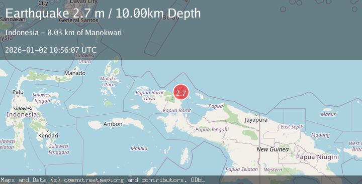
Earthquake NEAR N COAST OF PAPUA, INDONESIA
Fri, 02 Jan 2026 10:56:07 GMT
Time1 month ago
Location
-0.5700, 134.1500
Depth
10.0 KM
Event Summary
A 2.7 magnitude earthquake struck on NEAR N COAST OF PAPUA, INDONESIA, at Fri, 02 Jan 2026 10:56:07 GMT. Depth: 10km. Reviewed by BMKG seismologists, this minor quake occurred at a magnitude type of m.
Magnitude
2.7
m
Source
BMKG
Intensity
-
Agency Reports
1 Sources| Source | Magnitude | Depth | Time |
|---|---|---|---|
| BMKGPrimary | 2.7 | 10 km | 1 month ago |
Earthquake Details
AutomaticEvent IDemsc_BMKG_20260102_0000136
Tsunami PotentialNo
Magnitude Typem
Nearest Places
- Aipiri Canyons25.5 km
- Tanjung Saweba27.3 km
- Nuni27.7 km
- Kampung Tanah Rubuh27.9 km
- Kampung Meyunfoka28.2 km
Comments
Join the discussion about this event.
Latest Earthquakes
2.1Mag
Tarapaca, Chile
Time5 minutes ago
Depth8.18 km
SourceVYT (Automatic)
1.4Mag
12 km ESE of Olancha, CA
Time6 minutes ago
Depth7.15 km
SourceUSGS (Automatic)
2.8Mag
northwestern Russia
Time7 minutes ago
Depth10.00 km
SourceVYT (Automatic)
3.3Mag
Near North Coast of West Papua
Time7 minutes ago
Depth10.00 km
SourceBMKG
1.2Mag
5 km NNE of Fishhook, Alaska
Time8 minutes ago
Depth0.80 km
SourceUSGS (Automatic)
Nearby Earthquakes
3.0Mag
NEAR N COAST OF PAPUA, INDONESIA
Time5 years ago
Depth30.00 km
SourceDJA (Automatic)
3.0Mag
NEAR N COAST OF PAPUA, INDONESIA
Time6 months ago
Depth17.00 km
SourceBMKG (Automatic)
3.9Mag
West Papua Region, Indonesia
Time3 weeks ago
Depth18.14 km
SourceBMKG (Automatic)
2.6Mag
West Papua Region, Indonesia
Time2 weeks ago
Depth33.31 km
SourceBMKG (Automatic)
2.7Mag
NEAR N COAST OF PAPUA, INDONESIA
Time0 months ago
Depth11.00 km
SourceBMKG (Automatic)