Earthquake SOUTH OF BALI, INDONESIA
Fri, 02 Jan 2026 15:14:27 GMT
Time1 month ago
Location
-9.1900, 114.3600
Depth
22.0 KM
Event Summary
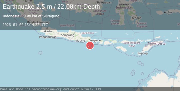
A 2.5 magnitude earthquake struck on SOUTH OF BALI, INDONESIA, at Fri, 02 Jan 2026 15:14:27 GMT. Depth: 22km. Reviewed by BMKG seismologists, this minor quake occurred at a magnitude type of m.
Magnitude
2.5
m
Source
BMKG
Intensity
-
Agency Reports
1 Sources| Source | Magnitude | Depth | Time |
|---|---|---|---|
| BMKGPrimary | 2.5 | 22 km | 1 month ago |
Earthquake Details
AutomaticEvent IDemsc_BMKG_20260102_0000200
Tsunami PotentialNo
Magnitude Typem
Nearest Places
- Pulau Batu Mandi47.1 km
- Tanjung Bantenan49.4 km
- Kali Bindo49.6 km
- Tanjung Purwo50.3 km
- Kali Karangmente52.3 km
Comments
Join the discussion about this event.
Latest Earthquakes
0.7Mag
7 km WNW of Cobb, CA
Time6 minutes ago
Depth1.75 km
SourceUSGS (Automatic)
1.2Mag
9 km N of Banning, CA
Time7 minutes ago
Depth18.03 km
SourceUSGS (Automatic)
2.1Mag
Southern California
Time8 minutes ago
Depth8.54 km
SourceVYT (Automatic)
2.2Mag
Sweden
Time12 minutes ago
Depth0.00 km
SourceVYT (Automatic)
2.6Mag
West Papua Region, Indonesia
Time15 minutes ago
Depth14.47 km
SourceBMKG
Nearby Earthquakes
3.0Mag
SOUTH OF BALI, INDONESIA
Time3 years ago
Depth13.00 km
SourceDJA (Automatic)
4.0Mag
SOUTH OF BALI, INDONESIA
Time3 years ago
Depth10.00 km
SourceDJA (Automatic)
2.7Mag
SOUTH OF BALI, INDONESIA
Time1 month ago
Depth34.00 km
SourceBMKG (Automatic)
3.0Mag
SOUTH OF BALI, INDONESIA
Time9 months ago
Depth20.00 km
SourceBMKG (Automatic)
3.0Mag
SOUTH OF BALI, INDONESIA
Time4 years ago
Depth58.00 km
SourceDJA (Automatic)