Earthquake PAPUA, INDONESIA
Sat, 03 Jan 2026 00:12:34 GMT
Time1 month ago
Location
-1.9500, 133.4400
Depth
10.0 KM
Event Summary
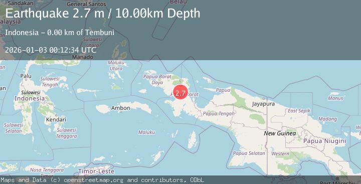
A 2.7 magnitude earthquake struck on PAPUA, INDONESIA, at Sat, 03 Jan 2026 00:12:34 GMT. Depth: 10km. Reviewed by BMKG seismologists, this minor quake occurred at a magnitude type of m.
Magnitude
2.7
m
Source
BMKG
Intensity
-
Agency Reports
1 Sources| Source | Magnitude | Depth | Time |
|---|---|---|---|
| BMKGPrimary | 2.7 | 15 km | 1 month ago |
Earthquake Details
AutomaticEvent IDemsc_BMKG_20260103_0000004
Tsunami PotentialNo
Magnitude Typem
Nearest Places
- Distrik Tembuni2.0 km
- Tembuni2.3 km
- Kampung Sibena Raya2.7 km
- Tisaida4.4 km
- Distrik Tuhiba4.7 km
Comments
Join the discussion about this event.
Latest Earthquakes
2.2Mag
Seram, Indonesia
Time2 minutes ago
Depth11.12 km
SourceBMKG
2.6Mag
West Papua Region, Indonesia
Time5 minutes ago
Depth17.35 km
SourceBMKG
2.8Mag
Antofagasta, Chile
Time8 minutes ago
Depth0.00 km
SourceVYT (Automatic)
3.3Mag
Near North Coast of West Papua
Time10 minutes ago
Depth10.00 km
SourceBMKG
2.5Mag
off the coast of Tarapaca, Chile
Time11 minutes ago
Depth0.00 km
SourceVYT (Automatic)
Nearby Earthquakes
2.2Mag
West Papua Region, Indonesia
Time5 hours ago
Depth26.69 km
SourceBMKG
5.1Mag
PAPUA, INDONESIA
Time10 years ago
Depth40.00 km
SourceEMSC (Automatic)
3.0Mag
PAPUA, INDONESIA
Time3 years ago
Depth10.00 km
SourceDJA (Automatic)
5.0Mag
PAPUA, INDONESIA
Time5 years ago
Depth40.00 km
SourceEMSC (Automatic)
4.0Mag
PAPUA, INDONESIA
Time5 years ago
Depth10.00 km
SourceDJA (Automatic)