Earthquake NEAR N COAST OF PAPUA, INDONESIA
Mon, 05 Jan 2026 06:41:34 GMT
Time1 month ago
Location
-2.2900, 139.9000
Depth
9.0 KM
Event Summary
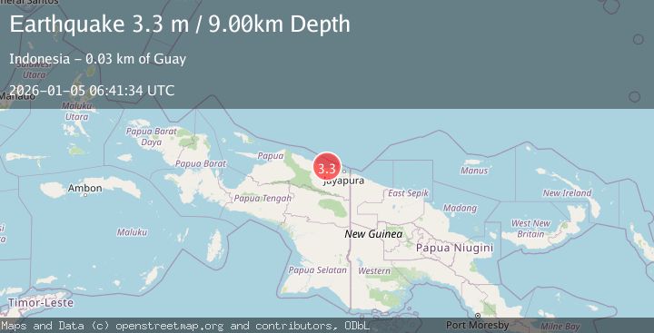
A 3.3 magnitude earthquake struck on NEAR N COAST OF PAPUA, INDONESIA, at Mon, 05 Jan 2026 06:41:34 GMT. Depth: 9km. Reviewed by BMKG seismologists, this minor quake occurred at a magnitude type of m.
Magnitude
3.3
m
Source
BMKG
Intensity
-
Agency Reports
1 Sources| Source | Magnitude | Depth | Time |
|---|---|---|---|
| BMKGPrimary | 3.3 | 9 km | 1 month ago |
Earthquake Details
AutomaticEvent IDemsc_BMKG_20260105_0000089
Tsunami PotentialNo
Magnitude Typem
Nearest Places
- Teluk Walckenaer6.2 km
- Sungai Mokalo9.8 km
- Kaptiau11.3 km
- Sungai Kapdi11.6 km
- Kampung Kapitiau12.1 km
Comments
Join the discussion about this event.
Latest Earthquakes
3.2Mag
Flores region, Indonesia
Time2 hours ago
Depth20.02 km
SourceVYT (Automatic)
3.1Mag
NORTH ISLAND OF NEW ZEALAND
Time3 hours ago
Depth223.90 km
SourceGNS (Automatic)
4.4Mag
UTTAR PRADESH, INDIA
Time3 hours ago
Depth10.00 km
SourceNDI (Automatic)
2.4Mag
WESTERN TURKEY
Time3 hours ago
Depth9.00 km
SourceKOERI (Automatic)
1.7Mag
Southeastern Alaska
Time3 hours ago
Depth26.25 km
SourceVYT (Automatic)
Nearby Earthquakes
2.8Mag
Near North Coast of West Papua
Time5 days ago
Depth29.81 km
SourceBMKG
3.0Mag
NEAR N COAST OF PAPUA, INDONESIA
Time2 years ago
Depth10.00 km
SourceDJA (Automatic)
2.8Mag
Near North Coast of West Papua
Time2 weeks ago
Depth10.00 km
SourceBMKG (Automatic)
3.0Mag
NEAR N COAST OF PAPUA, INDONESIA
Time2 years ago
Depth19.00 km
SourceDJA (Automatic)
5.4Mag
NEAR N COAST OF PAPUA, INDONESIA
Time3 years ago
Depth10.00 km
SourceEMSC (Automatic)