Earthquake NEAR N COAST OF PAPUA, INDONESIA
Mon, 05 Jan 2026 22:49:01 GMT
Time1 month ago
Location
-2.1900, 139.8800
Depth
15.0 KM
Event Summary
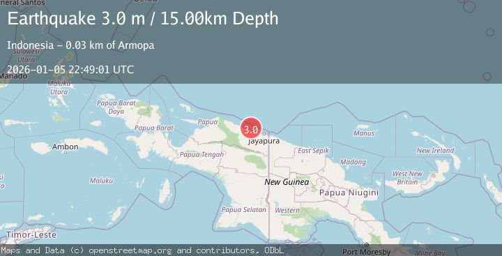
A 3.0 magnitude earthquake struck on NEAR N COAST OF PAPUA, INDONESIA, at Mon, 05 Jan 2026 22:49:01 GMT. Depth: 15km. Reviewed by BMKG seismologists, this minor quake occurred at a magnitude type of m.
Magnitude
3.0
m
Source
BMKG
Intensity
-
Agency Reports
1 Sources| Source | Magnitude | Depth | Time |
|---|---|---|---|
| BMKGPrimary | 3.0 | 15 km | 1 month ago |
Earthquake Details
AutomaticEvent IDemsc_BMKG_20260105_0000324
Tsunami PotentialNo
Magnitude Typem
Nearest Places
- Teluk Walckenaer15.8 km
- Sungai Mokalo20.9 km
- Kaptiau21.0 km
- Sungai Kapdi21.4 km
- Waiseron21.5 km
Comments
Join the discussion about this event.
Latest Earthquakes
2.2Mag
western Texas
Time2 minutes ago
Depth0.24 km
SourceVYT (Automatic)
2.2Mag
Valparaiso, Chile
Time3 minutes ago
Depth22.83 km
SourceVYT (Automatic)
4.5Mag
Central Alaska
Time4 minutes ago
Depth7.81 km
SourceVYT (Automatic)
1.9Mag
1 km SSW of Pāhala, Hawaii
Time8 minutes ago
Depth28.47 km
SourceUSGS (Automatic)
1.5Mag
5 km NW of The Geysers, CA
Time9 minutes ago
Depth2.47 km
SourceUSGS (Automatic)
Nearby Earthquakes
2.8Mag
Near North Coast of West Papua
Time5 days ago
Depth18.47 km
SourceBMKG
3.0Mag
NEAR N COAST OF PAPUA, INDONESIA
Time2 years ago
Depth10.00 km
SourceDJA (Automatic)
3.3Mag
NEAR N COAST OF PAPUA, INDONESIA
Time1 month ago
Depth9.00 km
SourceBMKG (Automatic)
4.0Mag
NEAR N COAST OF PAPUA, INDONESIA
Time6 years ago
Depth10.00 km
SourceDJA (Automatic)
2.8Mag
Near North Coast of West Papua
Time2 weeks ago
Depth10.00 km
SourceBMKG (Automatic)