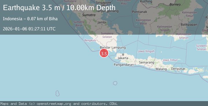
Earthquake SOUTHERN SUMATRA, INDONESIA
Tue, 06 Jan 2026 01:27:11 GMT
Time1 month ago
Location
-5.9600, 103.9700
Depth
10.0 KM
Event Summary
A 3.5 magnitude earthquake struck on SOUTHERN SUMATRA, INDONESIA, at Tue, 06 Jan 2026 01:27:11 GMT. Depth: 10km. Reviewed by BMKG seismologists, this minor quake occurred at a magnitude type of m.
Magnitude
3.5
m
Source
BMKG
Intensity
-
Agency Reports
1 Sources| Source | Magnitude | Depth | Time |
|---|---|---|---|
| BMKGPrimary | 3.5 | 10 km | 1 month ago |
Earthquake Details
AutomaticEvent IDemsc_BMKG_20260106_0000020
Tsunami PotentialNo
Magnitude Typem
Nearest Places
- Enggano Basin24.7 km
- Cukuh Batuberagam52.0 km
- Teluk Bengkunat52.8 km
- Pulau Betuah52.8 km
- Wai Cukung53.0 km
Comments
Join the discussion about this event.
Latest Earthquakes
1.0Mag
Southeastern Alaska
Time5 minutes ago
Depth0.00 km
SourceVYT (Automatic)
3.5Mag
COOK STRAIT, NEW ZEALAND
Time6 minutes ago
Depth75.30 km
SourceGNS (Automatic)
2.4Mag
Seram, Indonesia
Time8 minutes ago
Depth18.42 km
SourceBMKG
2.6Mag
West Papua Region, Indonesia
Time11 minutes ago
Depth17.35 km
SourceBMKG
5.0Mag
CENTRAL MID-ATLANTIC RIDGE
Time12 minutes ago
Depth10.00 km
SourceEMSC (Automatic)
Nearby Earthquakes
3.0Mag
SOUTHERN SUMATRA, INDONESIA
Time2 years ago
Depth10.00 km
SourceBMKG (Automatic)
3.0Mag
SOUTHERN SUMATRA, INDONESIA
Time3 months ago
Depth25.00 km
SourceBMKG (Automatic)
3.4Mag
SOUTHWEST OF SUMATRA, INDONESIA
Time1 month ago
Depth9.00 km
SourceBMKG (Automatic)
3.7Mag
Southwest of Sumatra, Indonesia
Time3 weeks ago
Depth3.70 km
SourceBMKG (Automatic)
5.6Mag
SOUTHERN SUMATRA, INDONESIA
Time10 years ago
Depth76.00 km
SourceEMSC (Automatic)