Earthquake BALI SEA
Thu, 08 Jan 2026 06:33:17 GMT
Time1 month ago
Location
-7.8100, 114.4400
Depth
16.0 KM
Event Summary
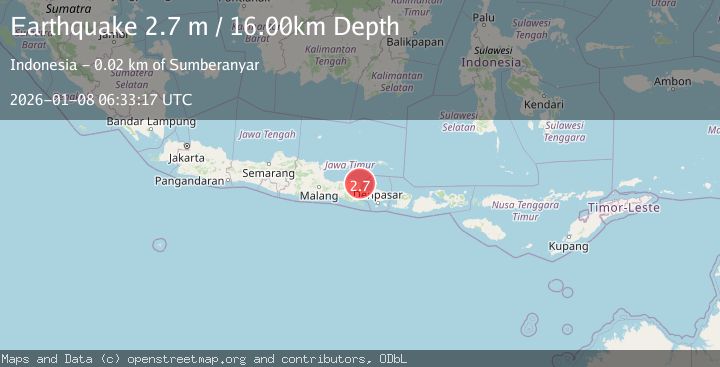
A 2.7 magnitude earthquake struck on BALI SEA, at Thu, 08 Jan 2026 06:33:17 GMT. Depth: 16km. Reviewed by BMKG seismologists, this minor quake occurred at a magnitude type of m.
Magnitude
2.7
m
Source
BMKG
Intensity
-
Agency Reports
1 Sources| Source | Magnitude | Depth | Time |
|---|---|---|---|
| BMKGPrimary | 2.7 | 16 km | 1 month ago |
Earthquake Details
AutomaticEvent IDemsc_BMKG_20260108_0000094
Tsunami PotentialNo
Magnitude Typem
Nearest Places
- Bukit Sekapa0.5 km
- Bukit Simacan0.6 km
- Tanjung Sumberbatok1.3 km
- Bukit Sedano1.4 km
- Teluk Masigit1.4 km
Comments
Join the discussion about this event.
Latest Earthquakes
1.0Mag
Southeastern Alaska
Time4 minutes ago
Depth0.00 km
SourceVYT (Automatic)
3.5Mag
COOK STRAIT, NEW ZEALAND
Time5 minutes ago
Depth75.30 km
SourceGNS (Automatic)
2.4Mag
Seram, Indonesia
Time6 minutes ago
Depth18.42 km
SourceBMKG
2.6Mag
West Papua Region, Indonesia
Time9 minutes ago
Depth17.35 km
SourceBMKG
2.8Mag
Antofagasta, Chile
Time13 minutes ago
Depth0.00 km
SourceVYT (Automatic)
Nearby Earthquakes
2.5Mag
BALI SEA
Time1 month ago
Depth13.00 km
SourceBMKG (Automatic)
2.3Mag
Bali Sea
Time1 week ago
Depth23.14 km
SourceBMKG (Automatic)
5.2Mag
BALI SEA
Time4 months ago
Depth10.00 km
SourceEMSC (Automatic)
3.0Mag
BALI SEA
Time3 years ago
Depth18.00 km
SourceDJA (Automatic)
2.7Mag
BALI SEA
Time0 months ago
Depth10.00 km
SourceBMKG (Automatic)