Earthquake NORTHERN SUMATRA, INDONESIA
Mon, 12 Jan 2026 10:36:44 GMT
Time1 month ago
Location
1.2100, 99.6300
Depth
99.0 KM
Event Summary
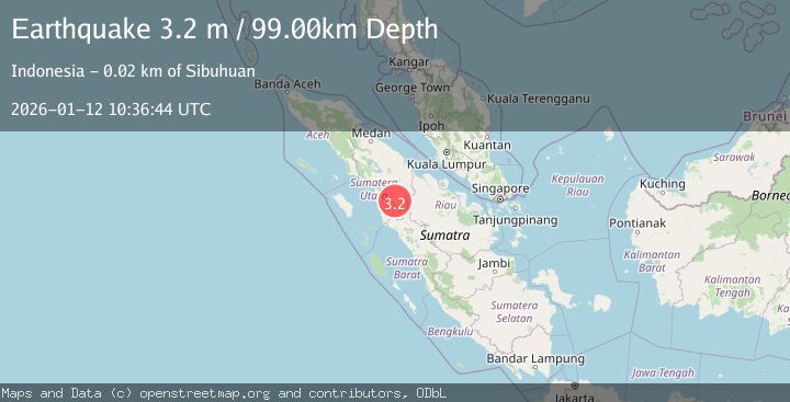
A 3.2 magnitude earthquake struck on NORTHERN SUMATRA, INDONESIA, at Mon, 12 Jan 2026 10:36:44 GMT. Depth: 99km. Reviewed by BMKG seismologists, this minor quake occurred at a magnitude type of m.
Magnitude
3.2
m
Source
BMKG
Intensity
-
Agency Reports
1 Sources| Source | Magnitude | Depth | Time |
|---|---|---|---|
| BMKGPrimary | 3.2 | 99 km | 1 month ago |
Earthquake Details
AutomaticEvent IDemsc_BMKG_20260112_0000156
Tsunami PotentialNo
Magnitude Typem
Nearest Places
- Aek Langge Menek0.4 km
- Aek Bargot2.0 km
- Aek Martona2.0 km
- Aek Martona2.3 km
- Aek Sarimbar2.3 km
Comments
Join the discussion about this event.
Latest Earthquakes
3.3Mag
offshore Valparaiso, Chile
Time11 minutes ago
Depth36.50 km
SourceVYT (Automatic)
4.2Mag
Mediterranean Region, Turkey
Time13 minutes ago
Depth10.00 km
SourceVYT (Automatic)
2.9Mag
Antofagasta, Chile
Time16 minutes ago
Depth267.46 km
SourceVYT (Automatic)
1.3Mag
10 km NW of Pine Valley, CA
Time16 minutes ago
Depth8.85 km
SourceUSGS (Automatic)
2.3Mag
Alaska Peninsula
Time24 minutes ago
Depth0.00 km
SourceVYT (Automatic)
Nearby Earthquakes
5.3Mag
NORTHERN SUMATRA, INDONESIA
Time5 years ago
Depth10.00 km
SourceEMSC (Automatic)
3.0Mag
northern Sumatra, Indonesia
Time1 week ago
Depth0.00 km
SourceVYT (Automatic)
3.0Mag
NORTHERN SUMATRA, INDONESIA
Time1 year ago
Depth10.00 km
SourceBMKG (Automatic)
2.7Mag
NORTHERN SUMATRA, INDONESIA
Time1 month ago
Depth10.00 km
SourceBMKG (Automatic)
2.3Mag
Northern Sumatra, Indonesia
Time1 week ago
Depth4.40 km
SourceBMKG (Automatic)