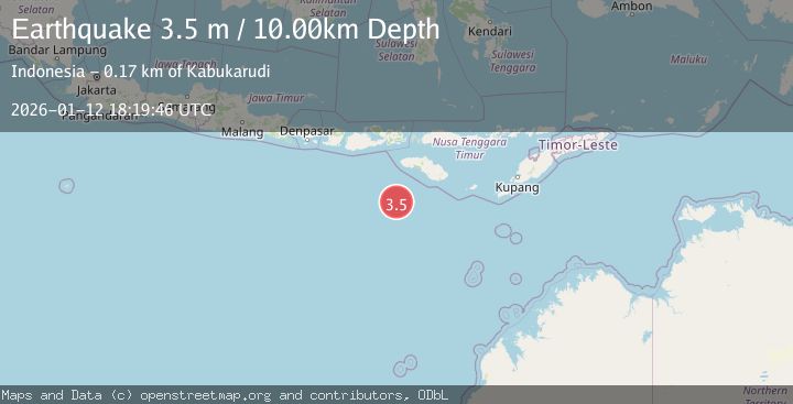
Earthquake SOUTH OF SUMBAWA, INDONESIA
Mon, 12 Jan 2026 18:19:46 GMT
Time1 month ago
Location
-11.1300, 118.8100
Depth
10.0 KM
Event Summary
A 3.5 magnitude earthquake struck on SOUTH OF SUMBAWA, INDONESIA, at Mon, 12 Jan 2026 18:19:46 GMT. Depth: 10km. Reviewed by BMKG seismologists, this minor quake occurred at a magnitude type of m.
Magnitude
3.5
m
Source
BMKG
Intensity
-
Agency Reports
1 Sources| Source | Magnitude | Depth | Time |
|---|---|---|---|
| BMKGPrimary | 3.5 | 10 km | 1 month ago |
Earthquake Details
AutomaticEvent IDemsc_BMKG_20260112_0000290
Tsunami PotentialNo
Magnitude Typem
Nearest Places
- Corona Bank140.4 km
- Watu Kalode158.5 km
- Tanjung Mambang158.8 km
- Tanjung Toroha159.1 km
- Loko Watukalabar159.3 km
Comments
Join the discussion about this event.
Latest Earthquakes
3.8Mag
Andreanof Islands, Aleutian Islands, Alaska
Time17 hours ago
Depth15.50 km
SourceVYT (Automatic)
1.7Mag
40 km NW of Toyah, Texas
Time17 hours ago
Depth4.25 km
SourceUSGS (Automatic)
1.3Mag
SWITZERLAND
Time17 hours ago
Depth7.60 km
SourceETHZ (Automatic)
3.8Mag
PHILIPPINE ISLANDS REGION
Time17 hours ago
Depth9.00 km
SourcePIVS (Automatic)
2.7Mag
Andreanof Islands, Aleutian Islands, Alaska
Time17 hours ago
Depth29.17 km
SourceVYT (Automatic)
Nearby Earthquakes
3.0Mag
SOUTH OF SUMBAWA, INDONESIA
Time1 month ago
Depth10.00 km
SourceBMKG (Automatic)
3.4Mag
South of Sumbawa, Indonesia
Time2 weeks ago
Depth10.00 km
SourceBMKG (Automatic)
3.7Mag
SOUTH OF SUMBAWA, INDONESIA
Time1 month ago
Depth10.00 km
SourceBMKG (Automatic)
5.2Mag
SOUTH OF SUMBAWA, INDONESIA
Time19 years ago
Depth30.00 km
SourceEMSC (Automatic)
3.2Mag
SOUTH OF SUMBAWA, INDONESIA
Time1 month ago
Depth14.00 km
SourceBMKG (Automatic)