Earthquake NORTHERN SUMATRA, INDONESIA
Mon, 12 Jan 2026 18:46:36 GMT
Time1 month ago
Location
0.0300, 99.9700
Depth
24.0 KM
Event Summary
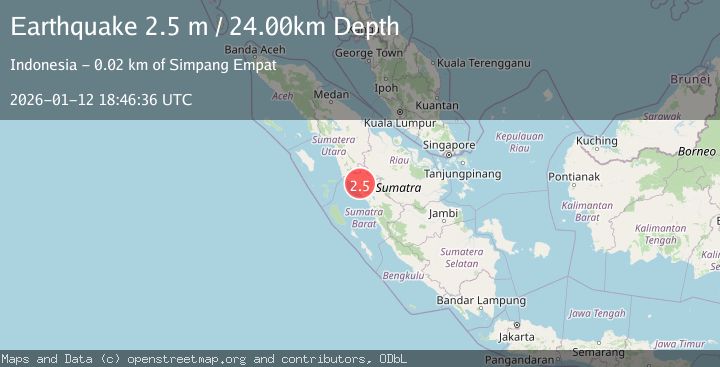
A 2.5 magnitude earthquake struck on NORTHERN SUMATRA, INDONESIA, at Mon, 12 Jan 2026 18:46:36 GMT. Depth: 24km. Reviewed by BMKG seismologists, this minor quake occurred at a magnitude type of m.
Magnitude
2.5
m
Source
BMKG
Intensity
-
Agency Reports
1 Sources| Source | Magnitude | Depth | Time |
|---|---|---|---|
| BMKGPrimary | 2.5 | 24 km | 1 month ago |
Earthquake Details
AutomaticEvent IDemsc_BMKG_20260112_0000296
Tsunami PotentialNo
Magnitude Typem
Nearest Places
- Bukit Rangkiang1.5 km
- Kotopilanduk5.5 km
- Gunung Ophir5.7 km
- Duriankandang6.1 km
- Kotapadang6.4 km
Comments
Join the discussion about this event.
Latest Earthquakes
1.8Mag
Southern Alaska
Time20 hours ago
Depth84.35 km
SourceVYT (Automatic)
3.8Mag
north of Halmahera, Indonesia
Time20 hours ago
Depth10.00 km
SourceVYT (Automatic)
2.5Mag
northern Sumatra, Indonesia
Time20 hours ago
Depth30.27 km
SourceVYT (Automatic)
4.2Mag
CENTRAL PERU
Time20 hours ago
Depth98.00 km
SourceLIM (Automatic)
1.5Mag
SWITZERLAND
Time20 hours ago
Depth-1.40 km
SourceETHZ (Automatic)
Nearby Earthquakes
2.7Mag
Northern Sumatra, Indonesia
Time2 weeks ago
Depth14.71 km
SourceBMKG (Automatic)
2.5Mag
NORTHERN SUMATRA, INDONESIA
Time3 weeks ago
Depth8.00 km
SourceBMKG (Automatic)
2.4Mag
Northern Sumatra, Indonesia
Time2 weeks ago
Depth9.60 km
SourceBMKG (Automatic)
3.0Mag
NORTHERN SUMATRA, INDONESIA
Time3 years ago
Depth10.00 km
SourceDJA (Automatic)
3.0Mag
NORTHERN SUMATRA, INDONESIA
Time3 years ago
Depth10.00 km
SourceDJA (Automatic)