Earthquake NEAR N COAST OF PAPUA, INDONESIA
Mon, 12 Jan 2026 21:47:57 GMT
Time1 month ago
Location
-2.8000, 136.0400
Depth
10.0 KM
Event Summary
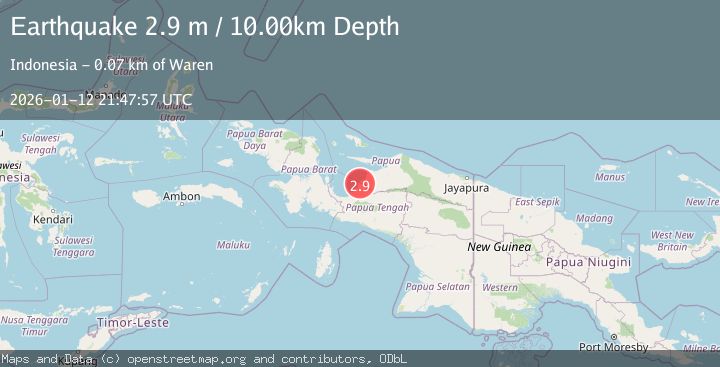
A 2.9 magnitude earthquake struck on NEAR N COAST OF PAPUA, INDONESIA, at Mon, 12 Jan 2026 21:47:57 GMT. Depth: 10km. Reviewed by BMKG seismologists, this minor quake occurred at a magnitude type of m.
Magnitude
2.9
m
Source
BMKG
Intensity
-
Agency Reports
1 Sources| Source | Magnitude | Depth | Time |
|---|---|---|---|
| BMKGPrimary | 2.9 | 10 km | 1 month ago |
Earthquake Details
AutomaticEvent IDemsc_BMKG_20260112_0000328
Tsunami PotentialNo
Magnitude Typem
Nearest Places
- Kampung Wapoga1.9 km
- Kampung Samanui5.5 km
- Kampung Keuw6.0 km
- Kampung Totoberi6.8 km
- Pami9.2 km
Comments
Join the discussion about this event.
Latest Earthquakes
1.0Mag
Southeastern Alaska
Time6 minutes ago
Depth0.00 km
SourceVYT (Automatic)
3.5Mag
COOK STRAIT, NEW ZEALAND
Time7 minutes ago
Depth75.30 km
SourceGNS (Automatic)
2.4Mag
Seram, Indonesia
Time8 minutes ago
Depth18.42 km
SourceBMKG
2.6Mag
West Papua Region, Indonesia
Time11 minutes ago
Depth17.35 km
SourceBMKG
5.0Mag
CENTRAL MID-ATLANTIC RIDGE
Time12 minutes ago
Depth10.00 km
SourceEMSC (Automatic)
Nearby Earthquakes
4.0Mag
NEAR N COAST OF PAPUA, INDONESIA
Time2 years ago
Depth10.00 km
SourceDJA (Automatic)
4.0Mag
NEAR N COAST OF PAPUA, INDONESIA
Time5 years ago
Depth14.00 km
SourceDJA (Automatic)
3.0Mag
NEAR N COAST OF PAPUA, INDONESIA
Time5 months ago
Depth18.00 km
SourceBMKG (Automatic)
4.1Mag
Papua, Indonesia
Time5 days ago
Depth1.71 km
SourceVYT (Automatic)
3.0Mag
NEAR N COAST OF PAPUA, INDONESIA
Time1 year ago
Depth11.00 km
SourceBMKG (Automatic)