Earthquake SOUTHERN SUMATRA, INDONESIA
Thu, 15 Jan 2026 10:41:11 GMT
Time1 month ago
Location
-3.0000, 101.6300
Depth
68.0 KM
Event Summary
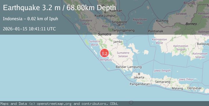
A 3.2 magnitude earthquake struck on SOUTHERN SUMATRA, INDONESIA, at Thu, 15 Jan 2026 10:41:11 GMT. Depth: 68km. Reviewed by BMKG seismologists, this minor quake occurred at a magnitude type of m.
Magnitude
3.2
m
Source
BMKG
Intensity
-
Agency Reports
1 Sources| Source | Magnitude | Depth | Time |
|---|---|---|---|
| BMKGPrimary | 3.2 | 68 km | 1 month ago |
Earthquake Details
AutomaticEvent IDemsc_BMKG_20260115_0000160
Tsunami PotentialNo
Magnitude Typem
Nearest Places
- Desa Talang Arah0.4 km
- Air Masat3.6 km
- Desa Bukit Harapan3.8 km
- Sungai Ombor4.0 km
- Desa Semambang Makmur4.2 km
Comments
Join the discussion about this event.
Latest Earthquakes
2.0Mag
Central Alaska
Time19 hours ago
Depth216.92 km
SourceVYT (Automatic)
1.8Mag
Region Metropolitana, Chile
Time19 hours ago
Depth14.89 km
SourceVYT (Automatic)
4.9Mag
Kepulauan Aru region, Indonesia
Time19 hours ago
Depth0.00 km
SourceVYT (Automatic)
2.5Mag
Poland
Time19 hours ago
Depth0.24 km
SourceVYT (Automatic)
1.2Mag
7 km SE of Winchester, CA
Time19 hours ago
Depth11.41 km
SourceUSGS (Automatic)
Nearby Earthquakes
4.0Mag
SOUTHERN SUMATRA, INDONESIA
Time2 years ago
Depth10.00 km
SourceBMKG (Automatic)
2.7Mag
Southern Sumatra, Indonesia
Time6 days ago
Depth32.93 km
SourceBMKG
5.1Mag
SOUTHERN SUMATRA, INDONESIA
Time18 years ago
Depth33.00 km
SourceEMSC (Automatic)
5.2Mag
SOUTHERN SUMATRA, INDONESIA
Time13 years ago
Depth107.00 km
SourceEMSC (Automatic)
3.0Mag
SOUTHERN SUMATRA, INDONESIA
Time5 months ago
Depth55.00 km
SourceBMKG (Automatic)