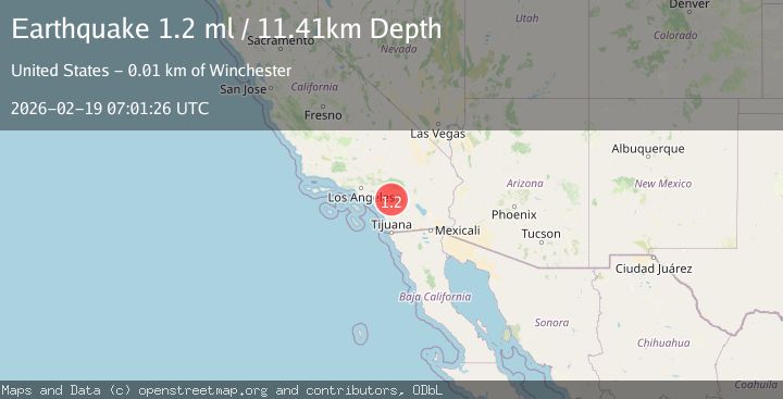
Earthquake 7 km SE of Winchester, CA
Thu, 19 Feb 2026 07:01:26 GMT
Time3 hours ago
Location
33.6680, -117.0233
Depth
11.4 KM
Event Summary
A 1.2 magnitude earthquake struck on 7 km SE of Winchester, CA, at Thu, 19 Feb 2026 07:01:26 GMT. Depth: 11.4099998474121km. Reviewed by USGS seismologists, this minor quake occurred at a magnitude type of ml.
Magnitude
1.2
ml
Source
USGS
Intensity
-
Agency Reports
1 Sources| Source | Magnitude | Depth | Time |
|---|---|---|---|
| USGSPrimary | 1.2 | 11 km | 3 hours ago |
Earthquake Details
AutomaticEvent IDusgs_ci41187855
Tsunami PotentialNo
Magnitude Typeml
Nearest Places
- Rawson Mountains0.2 km
- Diamond Valley1.7 km
- Perris Valley1.9 km
- Diamond Valley Lake2.0 km
- Quality Inn Lake Elsinore2.3 km
Comments
Join the discussion about this event.
Latest Earthquakes
1.8Mag
Region Metropolitana, Chile
Time3 hours ago
Depth14.89 km
SourceVYT (Automatic)
5.1Mag
Kepulauan Aru region, Indonesia
Time3 hours ago
Depth0.00 km
SourceVYT (Automatic)
2.5Mag
Poland
Time3 hours ago
Depth0.24 km
SourceVYT (Automatic)
2.1Mag
Region Metropolitana, Chile
Time3 hours ago
Depth10.00 km
SourceVYT (Automatic)
1.1Mag
7 km W of Cobb, CA
Time3 hours ago
Depth1.87 km
SourceUSGS (Automatic)
Nearby Earthquakes
1.8Mag
Southern California
Time4 days ago
Depth18.80 km
SourceVYT (Automatic)
0.8Mag
9 km SE of Winchester, CA
Time6 days ago
Depth13.04 km
SourceUSGS (Automatic)
0.6Mag
10 km SE of Winchester, CA
Time5 days ago
Depth12.09 km
SourceUSGS (Automatic)
1.6Mag
10 km SE of Winchester, CA
Time2 weeks ago
Depth12.75 km
SourceUSGS (Automatic)
2.3Mag
10 km SE of Winchester, CA
Time2 weeks ago
Depth13.06 km
SourceUSGS (Automatic)