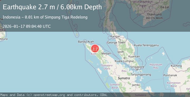
Earthquake NORTHERN SUMATRA, INDONESIA
Sat, 17 Jan 2026 09:04:40 GMT
Time1 month ago
Location
4.7500, 96.8200
Depth
6.0 KM
Event Summary
A 2.7 magnitude earthquake struck on NORTHERN SUMATRA, INDONESIA, at Sat, 17 Jan 2026 09:04:40 GMT. Depth: 6km. Reviewed by BMKG seismologists, this minor quake occurred at a magnitude type of m.
Magnitude
2.7
m
Source
BMKG
Intensity
-
Agency Reports
1 Sources| Source | Magnitude | Depth | Time |
|---|---|---|---|
| BMKGPrimary | 2.7 | 6 km | 1 month ago |
Earthquake Details
AutomaticEvent IDemsc_BMKG_20260117_0000095
Tsunami PotentialNo
Magnitude Typem
Nearest Places
- Gampong Pante Raya1.2 km
- Bur Telong1.4 km
- Gampong Wih Pesam1.5 km
- Burni Telong2.2 km
- Gampong Rembune2.7 km
Comments
Join the discussion about this event.
Latest Earthquakes
2.5Mag
Tarapaca, Chile
Time3 minutes ago
Depth112.55 km
SourceVYT (Automatic)
2.2Mag
Tarapaca, Chile
Time9 minutes ago
Depth111.94 km
SourceVYT (Automatic)
1.9Mag
Central Alaska
Time9 minutes ago
Depth32.10 km
SourceVYT (Automatic)
3.4Mag
HAWAII REGION, HAWAII
Time10 minutes ago
Depth4.70 km
SourceHV (Automatic)
1.9Mag
STRAIT OF GIBRALTAR
Time13 minutes ago
Depth0.00 km
SourceIGN (Automatic)
Nearby Earthquakes
2.8Mag
NORTHERN SUMATRA, INDONESIA
Time1 month ago
Depth6.00 km
SourceBMKG (Automatic)
2.5Mag
NORTHERN SUMATRA, INDONESIA
Time1 month ago
Depth10.00 km
SourceBMKG (Automatic)
3.0Mag
NORTHERN SUMATRA, INDONESIA
Time2 months ago
Depth10.00 km
SourceBMKG (Automatic)
2.6Mag
NORTHERN SUMATRA, INDONESIA
Time2 days ago
Depth10.00 km
SourceBMKG (Automatic)
2.4Mag
Northern Sumatra, Indonesia
Time1 day ago
Depth3.00 km
SourceBMKG