Earthquake NORTHERN SUMATRA, INDONESIA
Mon, 16 Feb 2026 21:04:54 GMT
Time2 days ago
Location
4.7200, 96.8100
Depth
10.0 KM
Event Summary
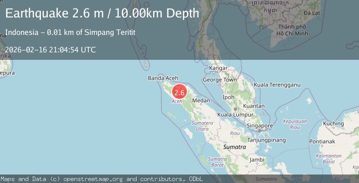
A 2.6 magnitude earthquake struck on NORTHERN SUMATRA, INDONESIA, at Mon, 16 Feb 2026 21:04:54 GMT. Depth: 10km. Reviewed by BMKG seismologists, this minor quake occurred at a magnitude type of m.
Magnitude
2.6
m
Source
BMKG
Intensity
-
Agency Reports
1 Sources| Source | Magnitude | Depth | Time |
|---|---|---|---|
| BMKGPrimary | 2.6 | 10 km | 2 days ago |
Earthquake Details
AutomaticEvent IDemsc_BMKG_20260216_0000318
Tsunami PotentialNo
Magnitude Typem
Nearest Places
- Burnitelong0.2 km
- Kecamatan Wih Pesam0.3 km
- Pondok Delapan Puluh Lima0.5 km
- Gampong Burni Telong0.6 km
- Pante Raya0.7 km
Comments
Join the discussion about this event.
Latest Earthquakes
2.4Mag
Bali Region, Indonesia
Time23 hours ago
Depth10.00 km
SourceBMKG
3.0Mag
Tarapaca, Chile
Time23 hours ago
Depth100.83 km
SourceVYT (Automatic)
2.1Mag
Sumbawa Region, Indonesia
Time23 hours ago
Depth10.00 km
SourceBMKG
3.3Mag
West Papua Region, Indonesia
Time23 hours ago
Depth10.00 km
SourceBMKG
2.4Mag
Java, Indonesia
Time23 hours ago
Depth14.70 km
SourceBMKG
Nearby Earthquakes
3.0Mag
NORTHERN SUMATRA, INDONESIA
Time2 months ago
Depth10.00 km
SourceBMKG (Automatic)
2.5Mag
NORTHERN SUMATRA, INDONESIA
Time1 month ago
Depth10.00 km
SourceBMKG (Automatic)
3.0Mag
NORTHERN SUMATRA, INDONESIA
Time1 month ago
Depth10.00 km
SourceBMKG (Automatic)
2.5Mag
Northern Sumatra, Indonesia
Time2 days ago
Depth10.00 km
SourceBMKG
3.0Mag
NORTHERN SUMATRA, INDONESIA
Time1 month ago
Depth4.00 km
SourceBMKG (Automatic)