Earthquake SUMBA REGION, INDONESIA
Sat, 17 Jan 2026 10:16:39 GMT
Time1 month ago
Location
-9.7500, 119.5400
Depth
39.0 KM
Event Summary
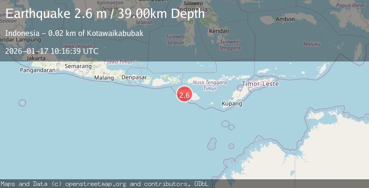
A 2.6 magnitude earthquake struck on SUMBA REGION, INDONESIA, at Sat, 17 Jan 2026 10:16:39 GMT. Depth: 39km. Reviewed by BMKG seismologists, this minor quake occurred at a magnitude type of m.
Magnitude
2.6
m
Source
BMKG
Intensity
-
Agency Reports
1 Sources| Source | Magnitude | Depth | Time |
|---|---|---|---|
| BMKGPrimary | 2.6 | 39 km | 1 month ago |
Earthquake Details
AutomaticEvent IDemsc_BMKG_20260117_0000108
Tsunami PotentialNo
Magnitude Typem
Nearest Places
- Loko Tangairi0.5 km
- Tengairi0.7 km
- Teluk Tangairi0.8 km
- Palindi Praikamoka0.8 km
- Loko Lamawura1.1 km
Comments
Join the discussion about this event.
Latest Earthquakes
3.0Mag
Region Metropolitana, Chile
Time1 minute ago
Depth127.56 km
SourceVYT (Automatic)
1.6Mag
Java, Indonesia
Time2 minutes ago
Depth0.24 km
SourceVYT (Automatic)
2.4Mag
western Texas
Time3 minutes ago
Depth22.83 km
SourceVYT (Automatic)
3.7Mag
Fox Islands, Aleutian Islands, Alaska
Time5 minutes ago
Depth11.96 km
SourceVYT (Automatic)
2.7Mag
Timor Region
Time8 minutes ago
Depth14.44 km
SourceBMKG
Nearby Earthquakes
2.7Mag
Sumba Region, Indonesia
Time3 weeks ago
Depth10.00 km
SourceBMKG (Automatic)
3.0Mag
SUMBA REGION, INDONESIA
Time6 months ago
Depth46.00 km
SourceBMKG (Automatic)
5.1Mag
SUMBA REGION, INDONESIA
Time1 year ago
Depth70.00 km
SourceEMSC (Automatic)
2.6Mag
Sumba Region, Indonesia
Time1 week ago
Depth46.11 km
SourceBMKG (Automatic)
3.0Mag
SUMBA REGION, INDONESIA
Time5 years ago
Depth25.00 km
SourceDJA (Automatic)