Earthquake SUMBA REGION, INDONESIA
Sat, 17 Jan 2026 16:10:44 GMT
Time1 month ago
Location
-10.1200, 119.4000
Depth
7.0 KM
Event Summary
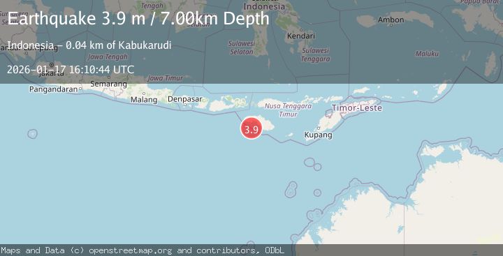
A 3.9 magnitude earthquake struck on SUMBA REGION, INDONESIA, at Sat, 17 Jan 2026 16:10:44 GMT. Depth: 7km. Reviewed by BMKG seismologists, this minor quake occurred at a magnitude type of m.
Magnitude
3.9
m
Source
BMKG
Intensity
-
Agency Reports
1 Sources| Source | Magnitude | Depth | Time |
|---|---|---|---|
| BMKGPrimary | 3.9 | 7 km | 1 month ago |
Earthquake Details
AutomaticEvent IDemsc_BMKG_20260117_0000184
Tsunami PotentialNo
Magnitude Typem
Nearest Places
- Tanjung Karoka35.9 km
- Ratiwodu36.8 km
- Praikapetang36.9 km
- Loko Kahobe37.0 km
- Kerijara37.2 km
Comments
Join the discussion about this event.
Latest Earthquakes
1.9Mag
British Columbia, Canada
Time1 minute ago
Depth0.00 km
SourceVYT (Automatic)
0.7Mag
84 km S of McCarthy, Alaska
Time3 minutes ago
Depth11.40 km
SourceUSGS (Automatic)
2.9Mag
Salta, Argentina
Time4 minutes ago
Depth255.49 km
SourceVYT (Automatic)
1.3Mag
4 km WSW of Calimesa, CA
Time4 minutes ago
Depth15.00 km
SourceUSGS (Automatic)
2.3Mag
Sumba Region, Indonesia
Time8 minutes ago
Depth7.66 km
SourceBMKG
Nearby Earthquakes
3.0Mag
SUMBA REGION, INDONESIA
Time4 months ago
Depth11.00 km
SourceBMKG (Automatic)
3.0Mag
SUMBA REGION, INDONESIA
Time3 years ago
Depth10.00 km
SourceDJA (Automatic)
3.0Mag
SUMBA REGION, INDONESIA
Time3 years ago
Depth28.00 km
SourceDJA (Automatic)
3.0Mag
SUMBA REGION, INDONESIA
Time4 months ago
Depth17.00 km
SourceBMKG (Automatic)
3.0Mag
SUMBA REGION, INDONESIA
Time7 months ago
Depth6.00 km
SourceBMKG (Automatic)