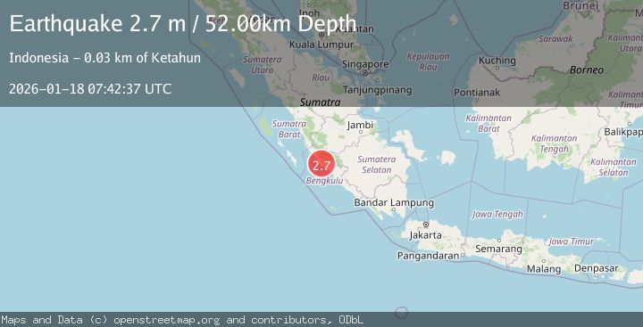
Earthquake SOUTHERN SUMATRA, INDONESIA
Sun, 18 Jan 2026 07:42:37 GMT
Time1 month ago
Location
-3.1800, 101.7200
Depth
52.0 KM
Event Summary
A 2.7 magnitude earthquake struck on SOUTHERN SUMATRA, INDONESIA, at Sun, 18 Jan 2026 07:42:37 GMT. Depth: 52km. Reviewed by BMKG seismologists, this minor quake occurred at a magnitude type of m.
Magnitude
2.7
m
Source
BMKG
Intensity
-
Agency Reports
1 Sources| Source | Magnitude | Depth | Time |
|---|---|---|---|
| BMKGPrimary | 2.7 | 52 km | 1 month ago |
Earthquake Details
AutomaticEvent IDemsc_BMKG_20260118_0000100
Tsunami PotentialNo
Magnitude Typem
Nearest Places
- Desa Karya Pelita0.8 km
- Desa Suka Makmur1.4 km
- Talanglumpang3.4 km
- Pematang Milang3.5 km
- Airlenang4.5 km
Comments
Join the discussion about this event.
Latest Earthquakes
1.4Mag
6 km SSW of Idyllwild, CA
Time2 hours ago
Depth15.02 km
SourceUSGS (Automatic)
2.4Mag
western Texas
Time2 hours ago
Depth6.10 km
SourceVYT (Automatic)
2.8Mag
Southern Alaska
Time2 hours ago
Depth14.04 km
SourceVYT (Automatic)
2.4Mag
Southern Alaska
Time2 hours ago
Depth139.28 km
SourceVYT (Automatic)
1.3Mag
3 km NNE of Moreno Valley, CA
Time2 hours ago
Depth17.92 km
SourceUSGS (Automatic)
Nearby Earthquakes
3.0Mag
SOUTHERN SUMATRA, INDONESIA
Time5 months ago
Depth55.00 km
SourceBMKG (Automatic)
3.4Mag
SOUTHERN SUMATRA, INDONESIA
Time1 month ago
Depth46.00 km
SourceBMKG (Automatic)
3.0Mag
SOUTHERN SUMATRA, INDONESIA
Time10 months ago
Depth38.00 km
SourceBMKG (Automatic)
5.2Mag
SOUTHERN SUMATRA, INDONESIA
Time18 years ago
Depth40.00 km
SourceEMSC (Automatic)
2.7Mag
SOUTHERN SUMATRA, INDONESIA
Time1 month ago
Depth44.00 km
SourceBMKG (Automatic)