Earthquake NEAR N COAST OF PAPUA, INDONESIA
Mon, 19 Jan 2026 11:05:08 GMT
Time1 month ago
Location
-0.8500, 131.4800
Depth
10.0 KM
Event Summary
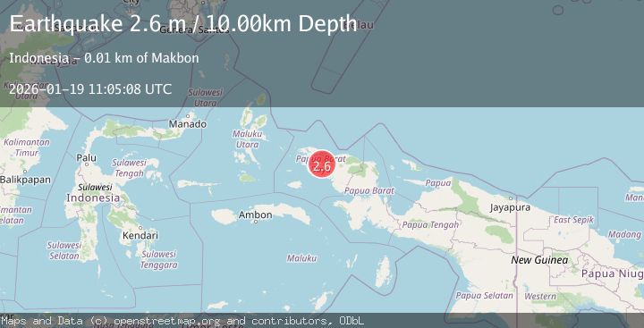
A 2.6 magnitude earthquake struck on NEAR N COAST OF PAPUA, INDONESIA, at Mon, 19 Jan 2026 11:05:08 GMT. Depth: 10km. Reviewed by BMKG seismologists, this minor quake occurred at a magnitude type of m.
Magnitude
2.6
m
Source
BMKG
Intensity
-
Agency Reports
1 Sources| Source | Magnitude | Depth | Time |
|---|---|---|---|
| BMKGPrimary | 2.6 | 10 km | 1 month ago |
Earthquake Details
AutomaticEvent IDemsc_BMKG_20260119_0000128
Tsunami PotentialNo
Magnitude Typem
Nearest Places
- 2.2 km
- 3.7 km
- 4.5 km
- 5.0 km
- 5.2 km
Comments
Join the discussion about this event.
Latest Earthquakes
5.8Mag
Minahasa, Sulawesi, Indonesia
Time2 minutes ago
Depth0.00 km
SourceVYT (Automatic)
1.1Mag
Pyrenees
Time3 minutes ago
Depth13.43 km
SourceVYT (Automatic)
3.2Mag
Antofagasta, Chile
Time6 minutes ago
Depth116.21 km
SourceVYT (Automatic)
0.8Mag
10 km NW of The Geysers, CA
Time6 minutes ago
Depth1.56 km
SourceUSGS (Automatic)
2.2Mag
Sumbawa region, Indonesia
Time9 minutes ago
Depth5.37 km
SourceVYT (Automatic)
Nearby Earthquakes
3.0Mag
NEAR N COAST OF PAPUA, INDONESIA
Time8 months ago
Depth10.00 km
SourceBMKG (Automatic)
2.2Mag
West Papua Region, Indonesia
Time1 month ago
Depth10.00 km
SourceBMKG (Automatic)
2.2Mag
near the north coast of Papua, Indonesia
Time6 hours ago
Depth0.00 km
SourceVYT (Automatic)
2.3Mag
West Papua Region, Indonesia
Time1 month ago
Depth10.00 km
SourceBMKG (Automatic)
4.0Mag
NEAR N COAST OF PAPUA, INDONESIA
Time4 years ago
Depth10.00 km
SourceDJA (Automatic)