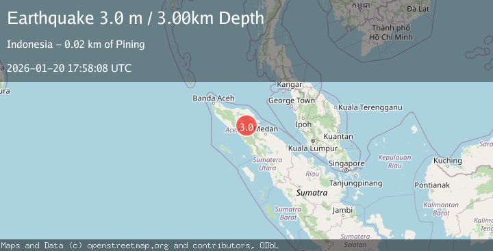
Earthquake NORTHERN SUMATRA, INDONESIA
Tue, 20 Jan 2026 17:58:08 GMT
Time0 months ago
Location
4.1500, 97.4500
Depth
3.0 KM
Event Summary
A 3.0 magnitude earthquake struck on NORTHERN SUMATRA, INDONESIA, at Tue, 20 Jan 2026 17:58:08 GMT. Depth: 3km. Reviewed by BMKG seismologists, this minor quake occurred at a magnitude type of m.
Magnitude
3.0
m
Source
BMKG
Intensity
-
Agency Reports
1 Sources| Source | Magnitude | Depth | Time |
|---|---|---|---|
| BMKGPrimary | 3.0 | 3 km | 0 months ago |
Earthquake Details
AutomaticEvent IDemsc_BMKG_20260120_0000274
Tsunami PotentialNo
Magnitude Typem
Nearest Places
- Gunung Aber2.6 km
- Burni Siluman3.5 km
- Gunung Lojang4.0 km
- Burni Apitan4.7 km
- Aer Putih4.9 km
Comments
Join the discussion about this event.
Latest Earthquakes
1.7Mag
western Texas
Time1 hour ago
Depth3.42 km
SourceVYT (Automatic)
3.8Mag
Seram, Indonesia
Time1 hour ago
Depth0.00 km
SourceVYT (Automatic)
1.6Mag
54 km WNW of Toyah, Texas
Time1 hour ago
Depth0.00 km
SourceUSGS (Automatic)
2.2Mag
West Papua Region, Indonesia
Time1 hour ago
Depth26.69 km
SourceBMKG
1.2Mag
WESTERN TURKEY
Time1 hour ago
Depth7.00 km
SourceAFAD (Automatic)
Nearby Earthquakes
2.6Mag
Northern Sumatra, Indonesia
Time2 weeks ago
Depth5.00 km
SourceBMKG (Automatic)
3.0Mag
NORTHERN SUMATRA, INDONESIA
Time5 months ago
Depth5.00 km
SourceBMKG (Automatic)
3.2Mag
Northern Sumatra, Indonesia
Time3 days ago
Depth3.00 km
SourceBMKG
2.6Mag
Northern Sumatra, Indonesia
Time2 weeks ago
Depth1.11 km
SourceBMKG (Automatic)
2.2Mag
Northern Sumatra, Indonesia
Time2 weeks ago
Depth5.00 km
SourceBMKG (Automatic)