Earthquake Tanimbar Islands Region, Indonesia
Sun, 01 Feb 2026 14:53:15 GMT
Time3 days ago
Location
-6.1498, 131.2095
Depth
209.0 KM
Event Summary
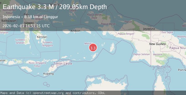
A 3.3 magnitude earthquake struck on Tanimbar Islands Region, Indonesia, at Sun, 01 Feb 2026 14:53:15 GMT. Depth: 209.045883km. Reviewed by BMKG seismologists, this minor quake occurred at a magnitude type of M.
Magnitude
3.3
M
Source
BMKG
Intensity
-
Agency Reports
1 Sources| Source | Magnitude | Depth | Time |
|---|---|---|---|
| BMKGPrimary | 3.3 | 209 km | 3 days ago |
Earthquake Details
AutomaticEvent IDbmg2026cfub
Tsunami PotentialNo
Magnitude TypeM
Nearest Places
- Weber Basin28.5 km
- Pulau Kalbur70.5 km
- Nuhututul70.6 km
- Melwuarniweyar71.9 km
- Desa Adodo Molu72.1 km
Comments
Join the discussion about this event.
Latest Earthquakes
2.3Mag
West Papua Region, Indonesia
Time5 minutes ago
Depth10.00 km
SourceBMKG (Automatic)
2.5Mag
NEAR S.E. COAST OF AUSTRALIA
Time16 minutes ago
Depth3.00 km
SourceAUST (Automatic)
2.3Mag
Sulawesi, Indonesia
Time19 minutes ago
Depth5.00 km
SourceBMKG (Automatic)
1.4Mag
16 km NW of Midland, Texas
Time26 minutes ago
Depth5.84 km
SourceUSGS (Automatic)
3.6Mag
GUATEMALA
Time29 minutes ago
Depth2.00 km
SourceINET (Automatic)
Nearby Earthquakes
3.8Mag
Tanimbar Islands Region, Indonesia
Time4 days ago
Depth84.48 km
SourceBMKG (Automatic)
3.5Mag
KEP. TANIMBAR REGION, INDONESIA
Time3 days ago
Depth14.00 km
SourceBMKG (Automatic)
3.4Mag
Banda Sea
Time1 week ago
Depth159.46 km
SourceBMKG (Automatic)
5.5Mag
Banda Sea
Time1 week ago
Depth155.21 km
SourceBMKG (Automatic)
5.2Mag
Banda Sea
Time3 days ago
Depth110.08 km
SourceBMKG (Automatic)