Earthquake KEPULAUAN BABAR, INDONESIA
Sun, 01 Feb 2026 17:02:31 GMT
Time3 days ago
Location
-7.3100, 129.3600
Depth
173.0 KM
Event Summary
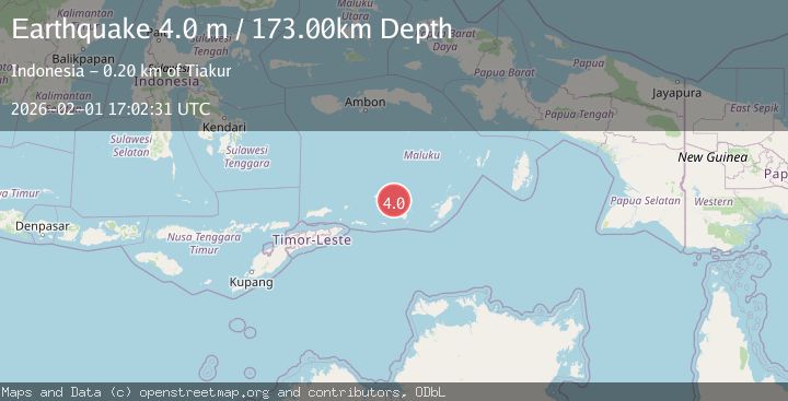
A 4.0 magnitude earthquake struck on KEPULAUAN BABAR, INDONESIA, at Sun, 01 Feb 2026 17:02:31 GMT. Depth: 173km. Reviewed by BMKG seismologists, this light quake occurred at a magnitude type of m.
Magnitude
4.0
m
Source
BMKG
Intensity
-
Agency Reports
1 Sources| Source | Magnitude | Depth | Time |
|---|---|---|---|
| BMKGPrimary | 4.0 | 173 km | 3 days ago |
Earthquake Details
AutomaticEvent IDemsc_BMKG_20260201_0000231
Tsunami PotentialNo
Magnitude Typem
Nearest Places
- Sirgurusi42.5 km
- Isu42.7 km
- Watludan42.9 km
- Desa Sinairusi43.2 km
- Pulau-pulau Damar43.4 km
Comments
Join the discussion about this event.
Latest Earthquakes
1.5Mag
13 km NNW of Sutcliffe, Nevada
Time4 hours ago
Depth7.82 km
SourceUSGS (Automatic)
3.0Mag
Off West Coast of Northern Sumatra
Time4 hours ago
Depth51.70 km
SourceBMKG (Automatic)
2.4Mag
NORTHERN CALIFORNIA
Time4 hours ago
Depth27.00 km
SourceNC (Automatic)
1.8Mag
4 km ESE of San Ramon, CA
Time4 hours ago
Depth4.41 km
SourceUSGS (Automatic)
1.6Mag
28 km NNE of Nellis Air Force Base, Nevada
Time5 hours ago
Depth4.22 km
SourceUSGS (Automatic)
Nearby Earthquakes
4.0Mag
Banda Sea
Time1 week ago
Depth252.67 km
SourceBMKG (Automatic)
4.5Mag
Banda Sea
Time2 weeks ago
Depth137.79 km
SourceUSGS
5.9Mag
Banda Sea
Time2 weeks ago
Depth102.35 km
SourceBMKG (Automatic)
5.0Mag
Banda Sea
Time4 days ago
Depth160.88 km
SourceBMKG (Automatic)
3.9Mag
Tanimbar Islands Region, Indonesia
Time6 days ago
Depth10.00 km
SourceBMKG (Automatic)