Earthquake HAIDA GWAII REGION
Mon, 19 Jan 2026 18:21:09 GMT
Time1 month ago
Location
52.6618, -132.1587
Depth
18.9 KM
Event Summary
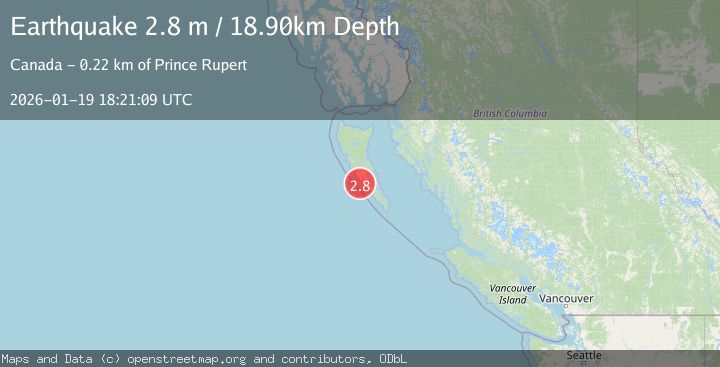
A 2.8 magnitude earthquake struck on HAIDA GWAII REGION, at Mon, 19 Jan 2026 18:21:09 GMT. Depth: 18.9km. Reviewed by CN seismologists, this minor quake occurred at a magnitude type of m.
Magnitude
2.8
m
Source
CN
Intensity
-
Agency Reports
1 Sources| Source | Magnitude | Depth | Time |
|---|---|---|---|
| CNPrimary | 2.8 | 19 km | 1 month ago |
Earthquake Details
AutomaticEvent IDemsc_CN_20260119_0000351
Tsunami PotentialNo
Magnitude Typem
Nearest Places
- 8.8 km
- 9.3 km
- 9.4 km
- 9.8 km
- 10.3 km
Comments
Join the discussion about this event.
Latest Earthquakes
2.2Mag
Minahasa, Sulawesi, Indonesia
Time1 minute ago
Depth18.92 km
SourceVYT (Automatic)
3.2Mag
Andreanof Islands, Aleutian Islands, Alaska
Time4 minutes ago
Depth0.12 km
SourceVYT (Automatic)
1.7Mag
21 km SE of Pāhala, Hawaii
Time5 minutes ago
Depth34.21 km
SourceUSGS (Automatic)
2.1Mag
Tarapaca, Chile
Time8 minutes ago
Depth100.10 km
SourceVYT (Automatic)
1.1Mag
55 km WNW of Tatitlek, Alaska
Time13 minutes ago
Depth20.40 km
SourceUSGS (Automatic)
Nearby Earthquakes
3.0Mag
HAIDA GWAII REGION
Time1 year ago
Depth21.90 km
SourceCN (Automatic)
3.0Mag
HAIDA GWAII REGION
Time8 months ago
Depth20.10 km
SourceCN (Automatic)
3.0Mag
QUEEN CHARLOTTE ISLANDS REGION
Time5 years ago
Depth23.00 km
SourceCN (Automatic)
3.0Mag
HAIDA GWAII REGION
Time9 months ago
Depth21.40 km
SourceCN (Automatic)
3.0Mag
HAIDA GWAII REGION
Time1 year ago
Depth19.40 km
SourceCN (Automatic)