Earthquake HALMAHERA, INDONESIA
Mon, 07 Jun 2021 18:50:23 GMT
Time4 years ago
Location
2.8600, 128.1600
Depth
104.0 KM
Event Summary
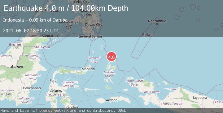
A 4.0 magnitude earthquake struck on HALMAHERA, INDONESIA, at Mon, 07 Jun 2021 18:50:23 GMT. Depth: 104km. Reviewed by DJA seismologists, this light quake occurred at a magnitude type of m.
Magnitude
4.0
m
Source
DJA
Intensity
-
Agency Reports
1 Sources| Source | Magnitude | Depth | Time |
|---|---|---|---|
| DJAPrimary | 4.0 | 104 km | 4 years ago |
Earthquake Details
AutomaticEvent IDemsc_DJA_20210607_0000173
Tsunami PotentialNo
Magnitude Typem
Nearest Places
- Morotai Basin23.6 km
- Tanjung Berri Berri44.1 km
- Tanjung Padangi45.0 km
- Tanjung Baku45.3 km
- Bere Bere45.5 km
Comments
Join the discussion about this event.
Latest Earthquakes
0.8Mag
10 km WNW of The Geysers, CA
Time14 hours ago
Depth1.96 km
SourceUSGS (Automatic)
2.4Mag
Sumbawa region, Indonesia
Time14 hours ago
Depth111.45 km
SourceVYT (Automatic)
2.3Mag
NORTHERN CALIFORNIA
Time14 hours ago
Depth2.90 km
SourceNC (Automatic)
2.6Mag
Northern Sumatra, Indonesia
Time14 hours ago
Depth12.27 km
SourceBMKG
0.7Mag
30 km SSE of Knik River, Alaska
Time14 hours ago
Depth7.80 km
SourceUSGS (Automatic)
Nearby Earthquakes
4.0Mag
HALMAHERA, INDONESIA
Time5 years ago
Depth10.00 km
SourceDJA (Automatic)
5.7Mag
HALMAHERA, INDONESIA
Time9 years ago
Depth60.00 km
SourceEMSC (Automatic)
5.0Mag
HALMAHERA, INDONESIA
Time5 years ago
Depth60.00 km
SourceEMSC (Automatic)
6.0Mag
HALMAHERA, INDONESIA
Time16 years ago
Depth45.00 km
SourceEMSC (Automatic)
3.1Mag
Halmahera, Indonesia
Time2 weeks ago
Depth118.67 km
SourceBMKG (Automatic)