Earthquake SOUTHERN SUMATRA, INDONESIA
Fri, 14 Sep 2007 06:01:32 GMT
Time18 years ago
Location
-4.0300, 101.2000
Depth
30.0 KM
Event Summary
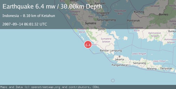
A 6.4 magnitude earthquake struck on SOUTHERN SUMATRA, INDONESIA, at Fri, 14 Sep 2007 06:01:32 GMT. Depth: 30km. Reviewed by EMSC seismologists, this strong quake occurred at a magnitude type of mw.
Magnitude
6.4
mw
Source
EMSC
Intensity
-
Agency Reports
1 Sources| Source | Magnitude | Depth | Time |
|---|---|---|---|
| EMSCPrimary | 6.4 | 30 km | 18 years ago |
Earthquake Details
AutomaticEvent IDemsc_EMSC_20070914_0000071
Tsunami PotentialNo
Magnitude Typemw
Nearest Places
- Pulau Mega18.8 km
- Mentawai Trough33.4 km
- Pulau Situpai86.6 km
- Pulau Sanding86.7 km
- Europa Reefs93.1 km
Comments
Join the discussion about this event.
Latest Earthquakes
1.7Mag
STRAIT OF GIBRALTAR
Time9 minutes ago
Depth15.80 km
SourceIGN (Automatic)
3.2Mag
Croatia-Bosnia and Herzegovina border region
Time13 minutes ago
Depth63.84 km
SourceVYT (Automatic)
1.0Mag
Southern Alaska
Time18 minutes ago
Depth13.43 km
SourceVYT (Automatic)
2.7Mag
Southeastern Alaska
Time19 minutes ago
Depth138.92 km
SourceVYT (Automatic)
1.7Mag
8 km ENE of Calumet, Oklahoma
Time19 minutes ago
Depth6.03 km
SourceUSGS (Automatic)
Nearby Earthquakes
5.5Mag
SOUTHERN SUMATRA, INDONESIA
Time5 years ago
Depth30.00 km
SourceEMSC (Automatic)
6.5Mag
SOUTHERN SUMATRA, INDONESIA
Time15 years ago
Depth30.00 km
SourceEMSC (Automatic)
5.4Mag
SOUTHERN SUMATRA, INDONESIA
Time17 years ago
Depth30.00 km
SourceEMSC (Automatic)
5.2Mag
SOUTHERN SUMATRA, INDONESIA
Time18 years ago
Depth40.00 km
SourceEMSC (Automatic)
5.3Mag
SOUTHERN SUMATRA, INDONESIA
Time18 years ago
Depth20.00 km
SourceEMSC (Automatic)